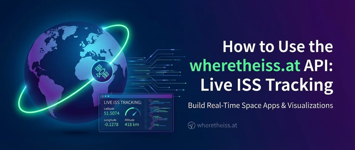
How to Use the wheretheiss.at API: Live ISS Tracking


1. Introduction: Gazing at the Invisible Giant
The International Space Station (ISS) stands as a monumental testament to human ingenuity, international collaboration, and our enduring quest to explore the cosmos. Circling Earth at an astounding speed of roughly 28,000 kilometers per hour (17,500 miles per hour), it completes an orbit approximately every 90 minutes. For those on the ground, witnessing the ISS traverse the night sky is a moment of pure wonder, a fleeting glimpse of humanity's orbital outpost. Its presence above us inspires awe, curiosity, and a deep appreciation for the scientific endeavors conducted onboard. Yet, for all its visibility under specific conditions, knowing its precise location at any given moment presents a unique, fascinating challenge for astronomers, space enthusiasts, and developers alike. How can we track this fast-moving celestial laboratory from the comfort of our homes or within our digital applications?
This is precisely where the power of Application Programming Interfaces (APIs) comes into play. APIs serve as the invisible bridges of the digital world, allowing disparate software systems to communicate, exchange data, and integrate functionalities seamlessly. They abstract away the complexity of underlying systems, presenting a clean, standardized interface for interaction. For anyone looking to harness data, whether it's weather forecasts, financial market trends, or indeed, the real-time position of objects in low Earth orbit, APIs are the indispensable tools that unlock a universe of possibilities.
In this comprehensive guide, we will embark on a detailed journey to explore wheretheiss.at, a beautifully straightforward and highly accessible public API that provides real-time position data for the International Space Station. We will delve into every aspect of its usage, from making your very first data request using basic command-line tools to parsing its JSON responses with popular programming languages like Python and JavaScript. Our exploration won't stop at mere data retrieval; we will then guide you through the exciting process of visualizing the ISS's dynamic path on an interactive map, transforming raw coordinates into a compelling visual experience using modern web technologies.
Furthermore, we will extend our discussion beyond simple API consumption, exploring how individual API interactions, like tracking the ISS, fit into the broader landscape of modern software development and enterprise API management. This includes understanding the critical roles played by sophisticated infrastructure components such as an API gateway and an API Developer Portal. These tools become absolutely essential as projects grow in complexity, requiring enhanced security, scalability, and streamlined developer experiences. By the end of this guide, you will not only be equipped with the practical skills to track humanity's orbital outpost in real-time but also gain a deeper appreciation for the architectural components that underpin the robust API ecosystems of today's digital world.
2. Demystifying the wheretheiss.at API: Your Gateway to Orbital Data
The wheretheiss.at API, hosted under the broader open-notify.org project, stands out in the vast ocean of APIs for its sheer simplicity and its commitment to open access. While many APIs demand intricate authentication schemes, subscription keys, or complex request headers, wheretheiss.at offers its valuable data freely and openly. This unencumbered access makes it an ideal pedagogical tool, serving as a perfect starting point for developers and enthusiasts who are taking their first steps into the fascinating world of API consumption. Its straightforward nature allows learners to focus on the core mechanics of making requests and parsing responses without getting bogged down by authentication complexities.
The Core Endpoint for Live Tracking
The primary resource for obtaining the ISS's current location is accessed via a single, simple HTTP GET request to the following URL:
http://api.open-notify.org/iss-now.json
Let's break down this URL and understand its components:
http://: This denotes the Hypertext Transfer Protocol, the foundation of data communication on the World Wide Web. Whilehttps://is generally preferred for secure communication,open-notify.orgprovideshttp://for this specific public endpoint, as the data itself is not sensitive and no personal information is transmitted.api.open-notify.org: This is the domain name of the API server.open-notify.orgis a project dedicated to providing open-source APIs for space-related data, andapiis a common subdomain convention for API services.iss-now.json: This is the specific endpoint or resource path we are requesting. It explicitly indicates that we are looking for the "ISS now" data, and the.jsonextension signifies that the expected response format will be JSON (JavaScript Object Notation), which has become the de facto standard for data exchange in modern web APIs due to its human-readability and ease of parsing by machines.
Understanding the JSON Response Structure
When you make a successful HTTP GET request to http://api.open-notify.org/iss-now.json, the API will respond with a JSON object. This object contains all the crucial information about the ISS's current position and the context of that data. Here's a typical structure of the response you can expect:
{
  "iss_position": {
    "latitude": "40.7128",
    "longitude": "-74.0060"
  },
  "message": "success",
  "timestamp": 1678886400
}
Let's dissect each field within this JSON response:
iss_position: This is a JSON object itself, containing the geographical coordinates of the ISS.latitude: This field holds the latitude of the ISS's current position, represented as a string. Latitude specifies the north-south position of a point on the Earth's surface. Values range from -90 (South Pole) to +90 (North Pole). It's crucial to note that it's delivered as a string, so you'll need to parse it into a floating-point number (e.g.,floatin Python,parseFloatin JavaScript) if you intend to perform calculations or plot it on a map.longitude: This field contains the longitude of the ISS's current position, also represented as a string. Longitude specifies the east-west position. Values range from -180 to +180. Like latitude, it requires conversion to a floating-point number for numerical operations.
message: This field is a simple status indicator for the API request. For a successful request where data is retrieved without issues, its value will invariably be"success". This is a useful field for basic error checking in your applications. If something goes wrong on the API's end, this field might contain a different message indicating the nature of the error.timestamp: This field provides the time at which the ISS position data was recorded, expressed as a Unix epoch timestamp. A Unix timestamp (also known as Unix time or POSIX time) represents the number of seconds that have elapsed since the Unix epoch, which is January 1, 1970, at 00:00:00 Coordinated Universal Time (UTC). This raw numerical value is extremely useful for programmatic date and time operations, but for human readability, you will typically convert it into a standard date and time format using your programming language's built-in date/time functionalities. This timestamp is absolutely crucial for understanding the freshness of the data and for properly sequencing historical tracking points.
Alternative Endpoint: Tracking Astronauts
While our primary focus for live tracking remains iss-now.json, it's worth briefly mentioning another related endpoint provided by open-notify.org:
http://api.open-notify.org/astros.json
This endpoint returns a list of all astronauts currently in space, including their craft and name. While not directly relevant to live tracking the ISS's position, it's a neat supplementary piece of information that demonstrates the breadth of data accessible through simple, open APIs. It typically returns a JSON structure like:
{
  "message": "success",
  "number": 7,
  "people": [
    {
      "craft": "ISS",
      "name": "Jasmin Moghbeli"
    },
    // ... other astronauts
  ]
}
API Reliability and Rate Limits
The wheretheiss.at API, as part of the open-notify.org project, is known for its remarkable reliability and generosity regarding rate limits. For personal projects, educational purposes, or even moderately scaled applications, you can typically poll the iss-now.json endpoint quite frequently (e.g., every few seconds) without encountering issues or being blocked. This permissive stance makes it an excellent choice for continuous, real-time tracking applications.
However, it is a crucial best practice in API development to always operate with the understanding that not all public APIs are as generous. Many commercial or more sensitive APIs impose strict rate limits to manage server load, prevent abuse, and ensure fair access for all users. Always consult the documentation for any API you intend to use to understand its specific terms of service, rate limit policies, and any authentication requirements. Even with wheretheiss.at, while generous, it's prudent to avoid excessively aggressive polling (e.g., multiple requests per second) to be a good API citizen and ensure the service remains available for everyone. This mindful approach to API consumption is a cornerstone of responsible API management.
3. First Contact: Fetching ISS Data
Now that we understand the structure and purpose of the wheretheiss.at API, it's time to roll up our sleeves and start interacting with it. We'll explore how to fetch data using various tools and programming languages, demonstrating the fundamental steps involved in making an API request, handling the response, and extracting the useful information.
The curl Command: The API Developer's Friend
For many developers, the curl command-line tool is the first utility they reach for when interacting with an API. curl is a powerful, versatile command-line utility for transferring data with URLs, supporting a wide range of protocols including HTTP, HTTPS, FTP, and more. It’s an invaluable tool for quickly testing endpoints, debugging API responses, and understanding the raw data returned by a service without writing any code.
To fetch the current ISS position using curl, simply open your terminal or command prompt and execute the following command:
curl http://api.open-notify.org/iss-now.json
Upon executing this command, you will immediately see the raw JSON response printed directly to your console, similar to the example shown in the previous section. This direct output allows for rapid verification of the API's functionality and the format of its data. It's a fundamental skill for any API developer.
Analyzing the Output: The output from curl is exactly what the API server sends back. You'll see the iss_position object with its latitude and longitude, the message (which should be "success"), and the timestamp. This raw view is crucial for confirming that the API is behaving as expected before integrating it into a more complex application.
Python: A Versatile Scripting Language for APIs
Python, with its clear syntax and a rich ecosystem of libraries, has become a go-to language for scripting, data processing, and interacting with APIs. The requests library in particular is highly favored for making HTTP requests due to its user-friendliness and robustness.
First, if you don't already have it, you'll need to install the requests library:
pip install requests
Now, let's write a Python script to fetch, parse, and display the ISS position data:
import requests
import json
import datetime

def get_iss_position():
    """
    Fetches the current position of the International Space Station (ISS)
    from the wheretheiss.at API and prints its coordinates and timestamp.
    """
    url = "http://api.open-notify.org/iss-now.json"
    print(f"Attempting to fetch ISS data from: {url}")
    try:
        # Make the HTTP GET request
        response = requests.get(url)

        # Raise an HTTPError for bad responses (4xx or 5xx)
        response.raise_for_status()

        # Parse the JSON response
        data = response.json()

        # Check the 'message' field for success
        if data["message"] == "success":
            timestamp = data["timestamp"]
            latitude = float(data["iss_position"]["latitude"])
            longitude = float(data["iss_position"]["longitude"])

            # Convert Unix timestamp to a human-readable datetime object
            dt_object = datetime.datetime.fromtimestamp(timestamp, tz=datetime.timezone.utc)

            print("\n--- ISS Position Data ---")
            print(f"Recorded UTC Time: {dt_object.isoformat()}")
            print(f"Latitude: {latitude}°")
            print(f"Longitude: {longitude}°")
            print("-------------------------")
            return latitude, longitude, dt_object
        else:
            print(f"API returned an error message: {data['message']}")
            return None, None, None
    except requests.exceptions.HTTPError as http_err:
        print(f"HTTP error occurred: {http_err} (Status Code: {response.status_code})")
        return None, None, None
    except requests.exceptions.ConnectionError as conn_err:
        print(f"Connection error occurred: {conn_err}. Check your internet connection or the API server.")
        return None, None, None
    except requests.exceptions.Timeout as timeout_err:
        print(f"Request timed out: {timeout_err}. The API server might be slow to respond.")
        return None, None, None
    except requests.exceptions.RequestException as req_err:
        print(f"An unexpected request error occurred: {req_err}")
        return None, None, None
    except json.JSONDecodeError as json_err:
        print(f"Failed to decode JSON response: {json_err}. Raw response: {response.text[:200]}...")
        return None, None, None
    except KeyError as key_err:
        print(f"Missing expected key in JSON response: {key_err}. Check API response structure.")
        return None, None, None

if __name__ == "__main__":
    lat, lon, dt = get_iss_position()
    if lat is not None:
        print("\nSuccessfully retrieved and processed ISS position using Python.")
    else:
        print("\nFailed to retrieve ISS position.")
Explanation of the Python Script:
import requests, json, datetime: We import necessary libraries.requestsfor making HTTP calls,jsonfor handling JSON data (thoughrequestsoften handles this automatically with.json()), anddatetimefor working with timestamps.requests.get(url): This is the core of the request. It sends an HTTP GET request to the specified URL.response.raise_for_status(): This is a crucial error-handling line. If the HTTP response status code indicates an error (e.g., 404 Not Found, 500 Internal Server Error), it will raise anHTTPError. This makes your script more robust.response.json(): Therequestslibrary intelligently detects that the response is JSON and automatically parses it into a Python dictionary.if data["message"] == "success":: We check themessagefield, as good practice dictates, to ensure the API processed the request successfully.float(data["iss_position"]["latitude"]): We access nested dictionary keys to getlatitudeandlongitude. Crucially, we convert them from strings to floating-point numbers usingfloat()because numerical operations and mapping libraries require actual numbers.datetime.datetime.fromtimestamp(timestamp, tz=datetime.timezone.utc): This converts the Unix timestamp (which is in seconds) into a more human-readabledatetimeobject, explicitly setting the timezone to UTC for accuracy.try...exceptblock: This robust error handling catches various types of exceptions that might occur during a network request or JSON parsing, providing informative messages to the user. This is vital for any production-ready application that relies on external APIs.
JavaScript (Node.js): For Server-Side Applications
JavaScript, especially with Node.js, is another dominant force in web development, equally capable of making server-side API requests. Modern Node.js versions (v18+) include the fetch API globally, similar to browsers. For older versions, you might need node-fetch.
If you are on an older Node.js version, install node-fetch:
npm install node-fetch
Here's how you'd fetch ISS data using JavaScript in a Node.js environment:
// For Node.js versions < 18, uncomment the line below:
// const fetch = require('node-fetch');

async function getIssPosition() {
    /**
     * Fetches the current position of the International Space Station (ISS)
     * from the wheretheiss.at API and logs its coordinates and timestamp.
     */
    const url = "http://api.open-notify.org/iss-now.json";
    console.log(`Attempting to fetch ISS data from: ${url}`);
    try {
        // Make the HTTP GET request using the global fetch API (Node.js v18+)
        const response = await fetch(url);

        // Check if the request was successful (status code 200-299)
        if (!response.ok) {
            throw new Error(`HTTP error! Status: ${response.status} - ${response.statusText}`);
        }

        // Parse the JSON response
        const data = await response.json();

        // Check the 'message' field for success
        if (data.message === "success") {
            const timestamp = data.timestamp;
            const latitude = parseFloat(data.iss_position.latitude);
            const longitude = parseFloat(data.iss_position.longitude);

            // Convert Unix timestamp (seconds) to JavaScript Date object (milliseconds)
            const date = new Date(timestamp * 1000);

            console.log("\n--- ISS Position Data ---");
            console.log(`Recorded UTC Time: ${date.toISOString()}`);
            console.log(`Latitude: ${latitude}°`);
            console.log(`Longitude: ${longitude}°`);
            console.log("-------------------------");
            return { latitude, longitude, date };
        } else {
            console.error(`API returned an error message: ${data.message}`);
            return null;
        }
    } catch (error) {
        console.error(`Error fetching data: ${error.message}`);
        return null;
    }
}

// This allows the function to be called when the script is run directly
if (require.main === module) {
    getIssPosition().then(pos => {
        if (pos) {
            console.log("\nSuccessfully retrieved and processed ISS position using Node.js.");
        } else {
            console.log("\nFailed to retrieve ISS position.");
        }
    });
}
Explanation of the JavaScript Script:
async function getIssPosition() { ... }: We define anasyncfunction, which allows us to useawaitfor cleaner asynchronous code.const response = await fetch(url);: This makes the HTTP GET request.awaitpauses the execution until the promise returned byfetchresolves.if (!response.ok): Theresponse.okproperty is a boolean indicating if the HTTP status code is in the 200-299 range (success). If not, we throw an error.const data = await response.json();: Similar to Python'sresponse.json(), this parses the JSON body of the response.parseFloat(data.iss_position.latitude): We useparseFloat()to convert the string latitude and longitude into floating-point numbers.const date = new Date(timestamp * 1000);: JavaScript'sDateobject constructor expects a timestamp in milliseconds, so we multiply the Unix timestamp (in seconds) by 1000.try...catchblock: Essential for handling network errors or issues with the API response, ensuring the application doesn't crash unexpectedly.if (require.main === module): This Node.js idiom allows thegetIssPosition()function to be called directly when the script is run (e.g.,node iss-tracker.js) but also permits the function to be imported and used as a module in other parts of a larger application.
With these examples, you now have the fundamental building blocks for retrieving ISS position data in two popular programming environments. The next step is to transform this raw data into a dynamic, visually engaging experience on a map.
APIPark is a high-performance AI gateway that allows you to securely access the most comprehensive LLM APIs globally on the APIPark platform, including OpenAI, Anthropic, Mistral, Llama2, Google Gemini, and more.Try APIPark now! 👇👇👇
4. Visualizing the Journey: Tracking the ISS on a Map
While latitude and longitude coordinates are precise and incredibly valuable, they remain abstract numbers to the human eye. To truly appreciate the ISS's relentless journey around our planet, nothing beats a dynamic, visual representation on a map. This section will guide you through the process of taking the raw data fetched from the wheretheiss.at API and plotting it on an interactive web map, bringing the ISS's orbital ballet to life.
Beyond Raw Data: Why Visualization Matters
The power of data visualization lies in its ability to transform complex datasets into digestible, intuitive insights. For something as dynamic as the ISS's movement, a map allows us to:
- Understand Context: See the ISS's position relative to continents, oceans, and specific geographic locations.
- Observe Patterns: Witness its orbital path, which appears to shift slightly with each pass due to Earth's rotation.
- Engage Users: An interactive map is far more captivating and informative than a list of coordinates.
Choosing a Mapping Library for the Web
When it comes to displaying maps on the web, developers have several excellent JavaScript libraries and APIs at their disposal. Each has its strengths, ideal use cases, and potential considerations:
- Leaflet.js: This is a modern, lightweight, open-source JavaScript library for mobile-friendly interactive maps. It's incredibly easy to use, highly customizable, and has a vast plugin ecosystem. It's an excellent choice for beginners and complex projects alike, particularly when you need fine-grained control and don't want to be locked into a specific commercial provider.
- Google Maps API: A powerful and feature-rich API offered by Google. It provides extensive mapping capabilities, including street view, directions, geocoding, and advanced styling. However, it typically requires an API key, and usage can incur costs for high-volume applications, making it less ideal for completely free, personal projects.
- OpenLayers: Another robust, open-source JavaScript library for high-performance, feature-rich maps. OpenLayers is known for its extensive capabilities and flexibility, making it suitable for enterprise-level GIS applications, though it can have a steeper learning curve than Leaflet.
- Mapbox GL JS: A library for building highly customized, vector-tile-based maps. It offers stunning visual fidelity and performance, especially for custom map styles, but also has its own pricing model and learning curve.
Our Choice: Leaflet.js
For our live ISS tracker, we will opt for Leaflet.js. Its simplicity, open-source nature, broad community support, and ease of integration make it the perfect candidate for quickly getting a dynamic map up and running without proprietary restrictions or immediate cost concerns. It allows us to focus on the core logic of fetching and updating the ISS position.
Setting up the HTML Structure (index.html)
Our web application will require a basic HTML file to serve as the foundation, where we'll include the Leaflet library and define the container for our map.
<!DOCTYPE html>
<html lang="en">
<head>
    <meta charset="UTF-8">
    <meta name="viewport" content="width=device-width, initial-scale=1.0">
    <title>Live ISS Tracker</title>
    <!-- Favicon for a touch of polish -->
    <link rel="icon" href="data:image/svg+xml,<svg xmlns=%22http://www.w3.org/2000/svg%22 viewBox=%220 0 100 100%22><text y=%22.9em%22 font-size=%2290%22>🛰️</text></svg>">

    <!-- Leaflet CSS for map styling -->
    <link rel="stylesheet" href="https://unpkg.com/leaflet@1.9.4/dist/leaflet.css"
        integrity="sha256-p4NxAoMmQTg9ZibYEPnAVXLkmL5PEtUFVCKimfCQCcQ="
        crossorigin=""/techblog/en/>
    <!-- Our custom CSS for the map container -->
    <link rel="stylesheet" href="style.css">

    <!-- Leaflet JavaScript library -->
    <script src="https://unpkg.com/leaflet@1.9.4/dist/leaflet.js"
        integrity="sha256-20nEF3z8zXw7j+KjJpE/V4C8vR7Fp/4/b8p8w8w8w8="
        crossorigin=""></script>
    <!-- Our custom JavaScript for the tracking logic -->
    <script src="app.js" defer></script>
</head>
<body>
    <h1>Live International Space Station Tracker</h1>
    <div id="issMap"></div>
    <div class="info-panel">
        <p><strong>Current Coordinates:</strong> <span id="coordinates">Loading...</span></p>
        <p><strong>Last Updated:</strong> <span id="timestamp">Loading...</span></p>
        <p class="status-message" id="statusMessage"></p>
    </div>
    <footer>
        <p>Data provided by <a href="http://open-notify.org/" target="_blank" rel="noopener noreferrer">Open Notify</a> (<a href="http://wheretheiss.at/" target="_blank" rel="noopener noreferrer">wheretheiss.at</a> API)</p>
        <p>Map tiles by <a href="https://www.openstreetmap.org/copyright" target="_blank" rel="noopener noreferrer">OpenStreetMap</a> contributors.</p>
    </footer>
</body>
</html>
And a minimal CSS file (style.css) to give our map a visible size:
body {
    font-family: Arial, sans-serif;
    margin: 0;
    padding: 20px;
    background-color: #f4f4f4;
    color: #333;
    display: flex;
    flex-direction: column;
    align-items: center;
    min-height: 100vh;
}

h1 {
    color: #2c3e50;
    margin-bottom: 20px;
    text-align: center;
}

#issMap {
    height: 600px; /* Make sure the map has a height */
    width: 100%;
    max-width: 900px; /* Limit width for better display on larger screens */
    background-color: #ddd; /* Placeholder background */
    border-radius: 8px;
    box-shadow: 0 4px 8px rgba(0, 0, 0, 0.1);
    margin-bottom: 20px;
}

.info-panel {
    background-color: #fff;
    padding: 15px 25px;
    border-radius: 8px;
    box-shadow: 0 2px 4px rgba(0, 0, 0, 0.05);
    margin-top: 15px;
    text-align: center;
    width: 100%;
    max-width: 900px;
}

.info-panel p {
    margin: 5px 0;
    font-size: 1.1em;
}

.info-panel strong {
    color: #555;
}

.status-message {
    color: #d9534f; /* Red for errors */
    font-weight: bold;
    margin-top: 10px;
}

footer {
    margin-top: auto; /* Pushes footer to the bottom */
    padding: 20px;
    text-align: center;
    color: #777;
    font-size: 0.9em;
}

footer a {
    color: #007bff;
    text-decoration: none;
}

footer a:hover {
    text-decoration: underline;
}

/* Custom icon styling for better visibility */
.iss-icon {
    background-image: url('data:image/svg+xml,<svg xmlns="http://www.w3.org/2000/svg" viewBox="0 0 100 100"><text x="5" y="90" font-size="90">🚀</text></svg>');
    background-size: cover;
    width: 40px; /* Adjust size as needed */
    height: 40px;
    border-radius: 50%; /* Make it round */
    border: 2px solid white;
    box-shadow: 0 0 5px rgba(0,0,0,0.5);
}
The JavaScript Logic (app.js)
This is where the magic happens. We'll write the JavaScript code to initialize the map, place a marker for the ISS, and then continuously update its position by fetching new data from the API.
// Initialize the map and set its initial view
// The coordinates (0, 0) and zoom level 1 are good starting points for a global view
const map = L.map('issMap').setView([0, 0], 1);
// Add OpenStreetMap tiles to the map
// These tiles provide the visual base layer for our map
L.tileLayer('https://{s}.tile.openstreetmap.org/{z}/{x}/{y}.png', {
maxZoom: 19,
attribution: '© <a href="https://www.openstreetmap.org/copyright">OpenStreetMap</a> contributors'
}).addTo(map);
// Create a custom icon for the ISS marker
// We use a rocket emoji for simplicity, but you could use a custom image
const issIcon = L.icon({
iconUrl: 'data:image/svg+xml,<svg xmlns="http://www.w3.org/2000/svg" viewBox="0 0 100 100"><text x="5" y="90" font-size="90">🚀</text></svg>',
iconSize: [40, 40], // Size of the icon
iconAnchor: [20, 20], // Point of the icon which will correspond to marker's location
});
// Create a marker for the ISS at an initial position
// We'll update this position dynamically
const issMarker = L.marker([0, 0], { icon: issIcon }).addTo(map);
// Select elements to display information
const coordinatesDisplay = document.getElementById('coordinates');
const timestampDisplay = document.getElementById('timestamp');
const statusMessageDisplay = document.getElementById('statusMessage');
// Function to fetch and update the ISS position
async function updateIssPosition() {
const url = "http://api.open-notify.org/iss-now.json";
try {
statusMessageDisplay.textContent = 'Fetching new data...';
statusMessageDisplay.style.color = '#007bff'; // Blue for loading
const response = await fetch(url);
if (!response.ok) {
throw new Error(`HTTP error! Status: ${response.status} - ${response.statusText}`);
}
const data = await response.json();
if (data.message === "success") {
const latitude = parseFloat(data.iss_position.latitude);
const longitude = parseFloat(data.iss_position.longitude);
const timestamp = data.timestamp;
// Update marker position
issMarker.setLatLng([latitude, longitude]);
// Optionally, pan the map to the new ISS position
// map.panTo([latitude, longitude]);
// Update info panel
coordinatesDisplay.textContent = `${latitude.toFixed(4)}°, ${longitude.toFixed(4)}°`;
const date = new Date(timestamp * 1000); // Convert Unix timestamp to milliseconds
timestampDisplay.textContent = date.toLocaleString(); // Human-readable date and time
// Update popup on marker (optional, but nice for interaction)
issMarker.bindPopup(`<b>ISS Position</b><br>Lat: ${latitude.toFixed(2)}°, Lng: ${longitude.toFixed(2)}°<br>As of: ${date.toLocaleTimeString()}`).openPopup();
statusMessageDisplay.textContent = 'Successfully updated.';
statusMessageDisplay.style.color = '#28a745'; // Green for success
} else {
const errorMessage = `API Error: ${data.message}`;
statusMessageDisplay.textContent = errorMessage;
statusMessageDisplay.style.color = '#d9534f'; // Red for error
console.error(errorMessage);
}
} catch (error) {
const errorMessage = `Failed to fetch ISS data: ${error.message}. Please check your connection or try again later.`;
statusMessageDisplay.textContent = errorMessage;
statusMessageDisplay.style.color = '#d9534f'; // Red for error
console.error(errorMessage);
// Fallback or retry logic could be implemented here
}
}
// Call the function immediately to load the initial position
updateIssPosition();
// Set an interval to update the ISS position every 5 seconds (5000 milliseconds)
// This creates the live tracking effect
setInterval(updateIssPosition, 5000);
Table: Key Map Library Features for Live Tracking
To provide a clearer comparison of popular web mapping libraries, especially for applications like live tracking, here’s a summary of their key features and considerations:
| Feature/Component | Leaflet.js | Google Maps API | OpenLayers | Description |
|---|---|---|---|---|
| Ease of Use (Setup) | High (Minimal setup for basic maps) | Medium (Requires API key, slightly more configuration) | Medium-High (Can be more verbose for simple tasks) | How quickly a developer can get a functional map running for live tracking. |
| API Key Needed | No (Uses OpenStreetMap or other open tiles) | Yes (Essential for most features, linked to billing) | No (Uses OpenStreetMap or other open tiles) | Requirement for authentication or billing setup, a key differentiator for hobby projects vs. commercial. |
| Cost | Free (Open Source, many free tile providers) | Usage-based (Freemium model, can incur costs) | Free (Open Source, many free tile providers) | Financial implications, especially for projects with high traffic or commercial intent. |
| Customization | High (Extensive plugin ecosystem) | Medium-High (Styled Maps, custom markers) | Very High (Deep control over all map aspects) | Flexibility in changing map appearance, adding custom UI elements, and extending functionality. |
| Tile Providers | Flexible (OpenStreetMap, Mapbox, etc.) | Google's own (can integrate custom/WMS) | Flexible (OpenStreetMap, custom, WMS, WMTS) | The variety and ease of integrating different base map visual styles and data sources. |
| Marker Update Method | setLatLng() |
setPosition() |
setGeometry() |
The specific API method used to dynamically change the geographical location of a marker on the map. |
| Mobile Friendliness | Excellent (Designed for touch devices) | Excellent (Responsive design built-in) | Good (Responsive design via CSS) | How well the map behaves and looks on various screen sizes and touch-enabled devices. |
| Community Support | Excellent (Active forums, docs, tutorials) | Excellent (Extensive official docs, large community) | Excellent (Strong community, detailed docs) | The availability of resources, documentation, and fellow developers to assist with issues or learning. |
| Common Use Cases | Simple web maps, mobile apps, data vis. | Enterprise apps, location-based services, navigation. | GIS applications, scientific mapping, complex data. | Typical scenarios where each library shines, helping developers choose the right tool for the job. |
How the JavaScript Code Works: A Step-by-Step Breakdown
L.map('issMap').setView([0, 0], 1);: This line initializes a new Leaflet map object.'issMap'refers to theidof thedivelement in our HTML where the map will be rendered.setView([0, 0], 1)sets the initial center of the map to[latitude, longitude](here, the equator and prime meridian) and the zoom level (1 is a very zoomed-out global view).
L.tileLayer(...): This adds the base map tiles. Tiles are small images that form the background of the map. We're using OpenStreetMap's standard tiles, which are free to use. The{s},{z},{x},{y}placeholders are replaced by Leaflet with the appropriate server, zoom level, and tile coordinates.maxZoom: Prevents zooming in too far on the tiles, which might become blurry.attribution: It's good practice and often required by tile providers to credit them, ensuring proper API etiquette.
const issIcon = L.icon(...): We create a custom icon for our ISS marker. Instead of a generic blue pin, a rocket emoji🚀makes it more visually appealing. TheiconSizeandiconAnchorproperties control the size of the icon and where its "point" should be relative to the actual coordinates.const issMarker = L.marker([0, 0], { icon: issIcon }).addTo(map);: This creates a new marker on the map.[0, 0]is its initial, placeholder position.{ icon: issIcon }applies our custom icon..addTo(map)adds the marker to our initialized map.
async function updateIssPosition() { ... }: This is the core function that will repeatedly fetch the ISS data.- It uses the browser's native
fetchAPI to make the HTTP request towheretheiss.at. This is similar to thenode-fetchorrequestslibrary we used earlier, but directly in the browser environment. response.okis checked for successful HTTP status codes.await response.json()parses the JSON response.parseFloat(...): Converts the string coordinates to numbers.issMarker.setLatLng([latitude, longitude]);: This is the key line for updating the marker. It moves the existing marker to the new coordinates without creating a new one, ensuring smooth updates.map.panTo([latitude, longitude]);: (Commented out in the example, but useful) If uncommented, this would automatically center the map on the ISS's new position with each update. For a global view, it might be distracting, but for a more zoomed-in, "follow the ISS" experience, it's very effective.issMarker.bindPopup(...): Attaches a popup to the marker that displays the current coordinates and timestamp when clicked..openPopup()makes it visible immediately after an update.- Error Handling: The
try...catchblock gracefully handles network errors or issues with the API response, updating thestatusMessagefor the user.
- It uses the browser's native
updateIssPosition();: We call the function once immediately to display the initial position as soon as the page loads.setInterval(updateIssPosition, 5000);: This function is critical for creating the "live tracking" effect. It repeatedly callsupdateIssPosition()every 5000 milliseconds (5 seconds). This polling mechanism ensures that the ISS's position on the map is regularly refreshed.
By combining HTML, CSS, and this JavaScript logic, you have successfully built a functional and visually engaging live ISS tracker! This basic setup can be extended with many more features, such as displaying the ISS's historical path, predicting its next visible pass, or even integrating data from other space-related APIs.
5. Beyond Basic Consumption: The Role of API Gateways and Developer Portals
Our journey so far has focused on the direct consumption of a public API like wheretheiss.at for a relatively simple, singular purpose: live ISS tracking. This direct approach is excellent for learning, personal projects, and specific use cases where an API is explicitly designed for open, unauthenticated access. However, as software development projects evolve, incorporating multiple APIs, handling varying levels of security, and supporting a diverse developer community, the challenges quickly multiply. What starts as a simple individual interaction can blossom into a complex, interconnected system that requires a more sophisticated approach to API management.
The Evolution of API Usage and Its Challenges at Scale
Consider a scenario where your ISS tracker becomes part of a larger "Global Space Data Platform." This platform might integrate:
wheretheiss.at: For real-time position.- NASA APIs: For satellite imagery, mission schedules, and scientific data.
- Commercial Satellite Operators' APIs: For specific high-resolution imagery or Earth observation data.
- Internal AI Services: Perhaps to predict space debris trajectories or analyze celestial phenomena.
- User APIs: Allowing users to subscribe to alerts for visible ISS passes in their location.
Managing such a diverse ecosystem of APIs presents significant challenges that go far beyond simple HTTP requests:
- Security: How do you protect your internal services from unauthorized access while still allowing legitimate third-party or internal applications to consume them? How do you manage API keys, tokens, and access policies across dozens of integrations?
- Management & Governance: Keeping track of different API versions, documentation, and access rules for each service becomes unwieldy. How do you ensure consistency and enforce best practices?
- Performance & Reliability: Aggregating data from multiple sources, some of which might be slow or unreliable, can introduce latency. How do you ensure your platform remains fast and available even under heavy load? Caching, load balancing, and efficient routing become critical.
- Monitoring & Analytics: Who is using which API? What are the usage patterns? Are there performance bottlenecks? Detailed monitoring is essential for operational visibility and proactive problem-solving.
- Developer Experience: How do internal teams or external partners easily discover, understand, and integrate with your platform's rich set of APIs? Poor developer experience leads to low adoption.
These challenges highlight the need for specialized tools that sit between the API consumers and the backend services. This is where the concepts of an API gateway and an API Developer Portal become not just beneficial, but absolutely indispensable.
The Solution: The API Gateway
An API gateway acts as a single, centralized entry point for all API calls into your backend services. It functions as both a traffic cop and a bouncer for your digital services, intercepting all requests, applying a set of policies, and then routing them to the appropriate backend service. It's an abstraction layer that decouples clients from the specific implementations of your backend services, significantly simplifying client-side interactions and providing a robust control point for API management.
Key Functions of an API Gateway:
- Authentication & Authorization: This is perhaps the most critical function. An API gateway can enforce security policies by verifying API keys, OAuth tokens, JWTs, or other credentials before forwarding requests. This offloads security logic from individual backend services. For our "Space Tracking Suite," the gateway would ensure only authorized applications can access the aggregated ISS data.
- Rate Limiting & Throttling: To prevent abuse, manage server load, and ensure fair usage, a gateway can impose limits on the number of requests a client can make within a certain timeframe. This is vital when integrating with third-party APIs (like
wheretheiss.at, if it had stricter limits) or when exposing your own services. The gateway could cache thewheretheiss.atresponse for a few seconds, reducing external calls and enhancing performance. - Routing & Load Balancing: The gateway efficiently directs incoming requests to the correct backend service instance. If you have multiple instances of your "Space Tracking Suite" service, the gateway can distribute traffic among them to ensure optimal performance and high availability.
- Caching: Frequently requested data can be stored at the gateway level, reducing the need to hit backend services or external APIs repeatedly. For instance, the ISS's position might be cached for 5-10 seconds, reducing the number of calls made to
wheretheiss.atwhile still providing near real-time data. - Request/Response Transformation: The gateway can modify request parameters or response bodies to ensure consistency or to adapt to different client needs. For example, it could add custom metadata to the
wheretheiss.atresponse or convert data formats. - Monitoring & Logging: By centralizing API traffic, the gateway becomes an ideal place to collect comprehensive logs and metrics on API usage, performance, and errors. This provides invaluable operational insights.
- Protocol Translation: Some advanced gateways can even translate between different communication protocols, bridging older systems with newer ones.
Scenario for an API Gateway: Imagine you've built your "Space Tracking Suite" as a collection of microservices, one for wheretheiss.at integration, another for NASA imagery, and a third for AI predictions. Instead of clients needing to know about and interact with three different endpoints, an API gateway provides a single, unified endpoint (e.g., api.myspacesuite.com). This gateway handles all the complexity, routing requests to the right service, securing access, and ensuring smooth operation, abstracting the backend architecture from the consumer.
The Solution: The API Developer Portal
Once you have your APIs secured and managed by an API gateway, the next challenge is making them accessible and understandable to the developers who will use them. This is where an API Developer Portal comes in. An API Developer Portal is a self-service platform that serves as the "storefront" for your API products. It provides all the necessary resources for developers (both internal and external) to discover, learn about, register for, and use your APIs efficiently. It is fundamentally about enhancing the developer experience (DX).
Key Functions of an API Developer Portal:
- API Discovery & Catalog: A central, searchable directory where developers can find all available APIs, often categorized by function or domain. This makes it easy to explore what your platform offers.
- Interactive Documentation: Gone are the days of static PDFs. Modern portals integrate interactive documentation (often based on OpenAPI/Swagger specifications) that allows developers to explore endpoints, understand parameters, view example requests/responses, and even "try out" API calls directly from the browser.
- API Key Management: Developers can self-register, obtain API keys, and manage their credentials through the portal, reducing the administrative burden on your operations team.
- Usage Analytics: Developers can monitor their own API consumption, track request volumes, and observe error rates, helping them understand their usage patterns and troubleshoot issues.
- Onboarding & Support: Comprehensive tutorials, getting-started guides, FAQs, and community forums or support ticket integration ensure developers have the resources they need to succeed.
- Versioning: The portal clearly communicates API versions, deprecation schedules, and migration guides, helping developers adapt to changes.
Scenario for an API Developer Portal: Once your "Space Tracking Suite" API is robustly managed by an API gateway, you need to onboard other developers. An API Developer Portal would list your Space Tracking Suite API, provide detailed documentation on how to query ISS position (which internally uses wheretheiss.at), access satellite imagery, or use AI prediction models. Developers could sign up, get an API key, test out endpoints, and read tutorials all from one centralized, user-friendly interface. This transforms a collection of services into a cohesive, discoverable product.
Connecting the Dots with APIPark
For organizations looking to go beyond simple API consumption and truly manage their API ecosystem, integrating multiple services, ensuring security, and streamlining developer access, robust platforms become indispensable. This is precisely where comprehensive solutions like APIPark come into play, offering an all-in-one platform for sophisticated API management.
APIPark - Open Source AI Gateway & API Management Platform is an all-in-one AI gateway and API developer portal that is open-sourced under the Apache 2.0 license. It is designed to help developers and enterprises manage, integrate, and deploy AI and REST services with ease. While our wheretheiss.at example focuses on a simple data API, APIPark provides the infrastructure needed to scale such individual API integrations into a full-fledged, enterprise-grade API ecosystem.
Let's look at how APIPark’s key features align with the advanced needs of building and managing a complex API landscape, even starting from a simple wheretheiss.at wrapper:
- Unified Management and Integration: Imagine your "Space Tracking Suite" integrates not only the
wheretheiss.atAPI but also a cutting-edge AI model that predicts optimal viewing times based on local weather, or perhaps an LLM that can generate educational content about the ISS. APIPark excels at the Quick Integration of 100+ AI Models and other REST services under a unified management system. This means whether you're dealing with thewheretheiss.atJSON response or a sophisticated AI output, APIPark can provide consistent authentication, cost tracking, and monitoring from a single pane of glass. This central control point ensures that integrating diverse APIs into your "Space Tracking Suite" is streamlined and manageable. - Standardized AI Invocation: If your space platform were to leverage AI for tasks like image recognition of Earth from the ISS, or for analyzing astronaut health data, APIPark’s feature for Unified API Format for AI Invocation would be invaluable. It standardizes request data formats across all AI models, ensuring that changes in underlying AI models or prompts do not break your application or microservices. This drastically simplifies AI usage and reduces maintenance costs, allowing your developers to focus on building features rather than wrestling with API versioning.
- Prompt Encapsulation for New APIs: Building on the previous point, APIPark allows users to Prompt Encapsulation into REST API. This means you could combine an AI model with a specific prompt – for instance, "summarize the latest ISS research findings" – and expose this as a new, custom API endpoint through APIPark. This capability is fantastic for quickly creating value-added services atop existing APIs, extending the functionality of your "Space Tracking Suite" with minimal development overhead.
- End-to-End API Lifecycle Management: As your "Space Tracking Suite" API grows, managing its lifecycle becomes paramount. APIPark assists with managing the entire lifecycle of APIs, including design, publication, invocation, and decommissioning. This ensures that your ISS tracking service, along with any other APIs you develop, adheres to regulated management processes, handles traffic forwarding, load balancing, and versioning effectively, moving beyond just raw data fetching to true API governance.
- Enhanced Developer Experience via API Developer Portal: For other developers to consume your "Space Tracking Suite" API, they need a robust API Developer Portal. APIPark fulfills this role, allowing for API Service Sharing within Teams and presenting a centralized display of all API services. This means developers can easily find, understand, and use your curated ISS tracking API, alongside any other REST or AI services, fostering collaboration and accelerating development. Features like API Resource Access Requires Approval ensure that callers must subscribe and await administrator approval, preventing unauthorized calls and enhancing security.
- Security and Performance at Scale: Even a simple API integration like
wheretheiss.atcan be wrapped by a gateway to enhance security and performance for your internal or external users. APIPark offers Independent API and Access Permissions for Each Tenant, enabling the creation of multiple teams with distinct security policies while sharing underlying infrastructure. Furthermore, its Performance Rivaling Nginx, achieving over 20,000 TPS with modest hardware and supporting cluster deployment, means that your API offerings—from simple data proxies to complex AI integrations—are highly available and performant, addressing the scalability concerns of any serious API management platform. - Operational Intelligence: APIPark provides Detailed API Call Logging and Powerful Data Analysis. This gives you granular insight into how your "Space Tracking Suite" API (and all other managed APIs) is being used, allowing you to quickly trace issues, monitor performance trends, and perform preventive maintenance, which is crucial for maintaining a reliable service for users fascinated by the ISS.
In essence, while our wheretheiss.at example is a simple starting point, APIPark provides the robust API gateway and API Developer Portal capabilities necessary to transform such individual API uses into a secure, scalable, and manageable ecosystem for enterprise-level applications, encompassing not just traditional REST APIs but also the rapidly expanding world of AI services.
6. Advanced Considerations and Best Practices
Building a basic live ISS tracker is an excellent achievement, but as with any software development, moving towards more robust, scalable, and professional applications requires considering several advanced factors and adhering to best practices. These considerations ensure your application is reliable, performs well, and respects the ecosystems it interacts with.
Client-Side vs. Server-Side Fetching
Our current live tracker fetches data directly from wheretheiss.at using client-side JavaScript in the browser. While convenient for simple projects, this approach has trade-offs:
- Client-Side Fetching (Direct from Browser):
- Pros:
- Simplicity: No backend server infrastructure is required, making deployment straightforward.
- Direct Interaction: The browser directly communicates with the API, reducing latency from an intermediate server.
- Scalability for API Provider: The API provider directly handles all client requests, offloading work from your own server.
- Cons:
- CORS (Cross-Origin Resource Sharing): Browsers enforce security policies that might prevent direct calls to APIs hosted on different domains. Fortunately,
wheretheiss.atexplicitly allows CORS, but many APIs do not. - Exposing API Keys: If the API required a key, embedding it directly in client-side JavaScript would expose it to anyone who views your page source, posing a significant security risk. (Not an issue for
wheretheiss.at). - Reliability: Reliance on the client's network connection and processing power.
- Limited Control: Less control over caching, rate limiting, and data transformation compared to a server.
- CORS (Cross-Origin Resource Sharing): Browsers enforce security policies that might prevent direct calls to APIs hosted on different domains. Fortunately,
- Pros:
- Server-Side Fetching (Via Your Own Backend/Proxy):
- Pros:
- Security: API keys can be stored securely on the server and never exposed to the client.
- CORS Circumvention: Your server acts as a proxy, making the request to the external API. The browser then makes a request to your server, which is on the same origin, thus avoiding CORS issues.
- Centralized Control: Allows for implementing caching, rate limiting, data transformation, and logging on your own terms. This is where an API gateway truly shines, as discussed earlier.
- Performance: A server can often make requests faster and can apply various optimizations before sending data to the client.
- Data Aggregation: Easier to combine data from multiple APIs on the server before sending a single, consolidated response to the client.
- Cons:
- Complexity: Requires a backend server and associated deployment/maintenance.
- Increased Latency: An extra hop (client -> your server -> external API -> your server -> client) can introduce slight delays.
- Pros:
Recommendation: For a simple, open API like wheretheiss.at, client-side fetching is perfectly acceptable and the easiest to implement. However, for any API that requires authentication, deals with sensitive data, or will be consumed by a high volume of clients, a server-side proxy or an API gateway is the unequivocally superior and more secure approach.
Error Handling and Robustness
Even the most reliable APIs can experience downtime or unexpected behavior. Robust error handling is crucial for building applications that are resilient and provide a good user experience:
- Network Issues: Your application should gracefully handle scenarios where the client loses internet connection or the API server is unreachable.
- API Downtime/Errors: The API might return non-200 HTTP status codes (e.g., 404, 500) or a malformed response. Your code should check for
response.ok(JavaScript) orresponse.raise_for_status()(Python) and parse error messages if provided by the API (likedata.messageinwheretheiss.at). - Graceful Degradation: Instead of crashing, your application should display user-friendly error messages (e.g., "Failed to load ISS position, please try again later"), show cached data, or display a static map.
- Retry Mechanisms with Backoff: For transient network errors, implementing a retry mechanism that waits for increasing periods between retries (exponential backoff) can improve reliability without overwhelming the API server.
Performance Optimization
While wheretheiss.at is forgiving, applying performance best practices is essential for any API-driven application:
- Polling Interval: Don't over-poll. For the ISS, an update every 5-10 seconds is generally sufficient. More frequent updates offer diminishing returns and unnecessarily burden the API server (and your client's resources).
- Caching: As mentioned, an API gateway can implement server-side caching. For client-side, you might consider basic in-memory caching if data doesn't need to be strictly real-time and updates are infrequent.
- Efficient Map Updates: When updating a marker's position, only change its
LatLngproperty (marker.setLatLng()) instead of recreating the entire marker or map. This is what we implemented in our JavaScript example. - Resource Management: Ensure your client-side application isn't leaking memory or continuously adding event listeners without cleaning them up, especially in long-running applications.
API Etiquette and Ethical Use
Being a responsible API developer and consumer is paramount:
- Read Terms of Service: Always read and understand the API's terms of service and acceptable use policy. This includes rate limits, restrictions on commercial use, and attribution requirements.
- Respect Rate Limits: Even if an API seems permissive, design your application to respect any stated rate limits. If no limits are explicitly stated, err on the side of caution with your polling frequency. Overloading an API can lead to your IP being blocked.
- Provide a
User-AgentHeader: When making requests, especially from a server, include aUser-Agentheader that identifies your application (e.g.,MyISSTrackerApp/1.0 (contact@example.com)). This helps API providers understand who is using their service and can assist them in troubleshooting or contacting you if there are issues. - Don't Scrape if an API Exists: If an official API provides the data you need, use it. Screen scraping (parsing HTML to extract data) is generally more fragile, less efficient, and often violates website terms of service.
- Data Attribution: Always attribute the data source as required. For OpenStreetMap tiles and
wheretheiss.at, we've included appropriate attributions in ourindex.html.
Data Accuracy and Limitations
While wheretheiss.at provides highly accurate real-time data, it's important to understand the inherent limitations of any such system:
- Latency: There is always a tiny delay between the ISS's actual physical position, when that position is observed/calculated, when it's made available via the API, and when your application fetches and displays it. For
wheretheiss.at, this latency is typically very low (a few seconds) and perfectly acceptable for general tracking. - Precision: The coordinates provided are very precise, but it's worth noting that the "point" of the ISS refers to its center of mass. For a station as large as the ISS, this is a conceptual point.
- Prediction vs. Observation: APIs like
wheretheiss.atoften rely on constantly updated orbital models and ground station observations, making their "real-time" data very close to the actual position. For future predictions, other APIs and models (like those from NORAD or other space agencies) might be used, which introduce their own error margins over time.
By considering these advanced aspects, you can elevate your ISS tracker from a functional demo to a truly robust, user-friendly, and responsibly built application that can scale and adapt over time. The principles discussed here are universally applicable across various API development scenarios, reinforcing the importance of diligent API management practices.
7. Conclusion: The Power of Connectivity
Our journey through the world of the wheretheiss.at API has been both illuminating and practical. We began by unraveling the simple yet powerful wheretheiss.at API, understanding its structure and the invaluable real-time data it provides about the International Space Station. From there, we rolled up our sleeves to make our first API calls using fundamental tools like curl and robust programming languages such as Python and JavaScript. We meticulously walked through the process of fetching raw data, parsing its JSON response, and extracting critical information like latitude, longitude, and timestamps.
The true magic unfolded as we transitioned from abstract numbers to a vivid, interactive visualization. By leveraging the lightweight and flexible Leaflet.js library, we transformed raw coordinates into a dynamic live map, allowing us to track the ISS's incredible journey across the globe in real-time. This hands-on experience not only demonstrated the fundamental principles of API consumption and data visualization but also underscored how readily accessible tools can bring complex scientific data to life for anyone with an internet connection.
Crucially, our exploration did not stop at individual API interactions. We ventured into the broader, more complex landscape of modern software development, where singular API calls often evolve into intricate ecosystems. This led us to understand the critical roles played by sophisticated API management tools: the API gateway and the API Developer Portal. We learned how an API gateway acts as a security guard, traffic cop, and performance enhancer for your API services, while an API Developer Portal serves as the inviting storefront, making your APIs discoverable, understandable, and easy for other developers to integrate.
In this context, we naturally recognized the value of platforms like APIPark. APIPark - Open Source AI Gateway & API Management Platform (ApiPark) stands out as a comprehensive solution designed to bridge the gap between simple API consumption and enterprise-grade API governance. It exemplifies how a single platform can manage a diverse array of APIs—from straightforward data providers like wheretheiss.at (perhaps wrapped within a larger service) to complex AI models—offering unified authentication, lifecycle management, robust security, high performance, and an exceptional developer experience. Whether you're integrating sophisticated AI capabilities or simply providing a secure, managed layer over external REST APIs, APIPark provides the infrastructure to do so effectively.
Ultimately, this guide aimed to empower you, the developer, the enthusiast, the curious mind. APIs are the connective tissue of the digital age, enabling countless innovative applications by seamlessly connecting disparate data sources and services. Whether your passion lies in tracking satellites, analyzing global trends, integrating cutting-edge AI capabilities into your applications, or simply building a cool personal project, the foundational principles of API interaction and diligent API management remain universally applicable and profoundly empowering.
So, take this knowledge, experiment, build, and innovate. The universe of data is vast and waiting for you to unlock its boundless potential.
8. Frequently Asked Questions (FAQs)
Q1: What is wheretheiss.at and what kind of data does it provide?
wheretheiss.at is a public, open-source API (hosted by open-notify.org) that provides real-time position data for the International Space Station (ISS). It offers the current latitude, longitude, and a Unix timestamp of when that data was recorded. It's known for its simplicity and ease of use, making it ideal for educational purposes and personal projects that require live ISS tracking.
Q2: Is the wheretheiss.at API free to use and are there any rate limits?
Yes, the wheretheiss.at API is completely free and open for public use. It is very generous with its rate limits, allowing frequent polling (e.g., every 5-10 seconds) for most applications without issues. However, it's always good API etiquette to avoid excessively aggressive polling to ensure the service remains available for all users.
Q3: Why would I need an API Gateway or an API Developer Portal for a simple API like wheretheiss.at?
While you might not need an API gateway or API Developer Portal for directly consuming wheretheiss.at in a simple app, these tools become essential as your projects grow in complexity. If you were building a larger "Space Tracking Suite" that combines wheretheiss.at with other APIs (e.g., NASA data, AI services), an API gateway would provide centralized security (authentication, authorization), rate limiting, caching (to reduce external calls), and unified routing. An API Developer Portal would then make your aggregated "Space Tracking Suite" API discoverable, documented, and easily consumable by other developers, ensuring effective API management and a great developer experience.
Q4: Can I use the wheretheiss.at API to predict future ISS passes over my location?
The wheretheiss.at API primarily provides the current real-time position of the ISS. While you could technically use a series of data points to infer its orbital path, it does not directly offer prediction capabilities for future passes over specific locations. For such predictions, you would typically need to use more advanced orbital mechanics libraries or other specialized APIs (like those from space agencies) that are designed for trajectory forecasting.
Q5: How can APIPark help beyond simple ISS tracking?
APIPark (ApiPark.com) is an open-source AI gateway and API management platform designed for comprehensive API governance. While not strictly necessary for simple wheretheiss.at usage, it provides enterprise-grade features that become critical when managing a multitude of APIs, especially those involving AI. APIPark helps by offering: * Unified management for 100+ AI models and REST services. * End-to-end API lifecycle management (design, publish, invoke, decommission). * Robust security (access permissions, approval workflows). * High performance (20,000+ TPS). * An API Developer Portal for seamless API discovery and developer onboarding. * Detailed analytics and logging. Essentially, APIPark allows you to transform individual API integrations, like wrapping wheretheiss.at data, into a scalable, secure, and easily manageable API product within a larger, more complex application ecosystem.
🚀You can securely and efficiently call the OpenAI API on APIPark in just two steps:
Step 1: Deploy the APIPark AI gateway in 5 minutes.
APIPark is developed based on Golang, offering strong product performance and low development and maintenance costs. You can deploy APIPark with a single command line.
curl -sSO https://download.apipark.com/install/quick-start.sh; bash quick-start.sh

In my experience, you can see the successful deployment interface within 5 to 10 minutes. Then, you can log in to APIPark using your account.

Step 2: Call the OpenAI API.