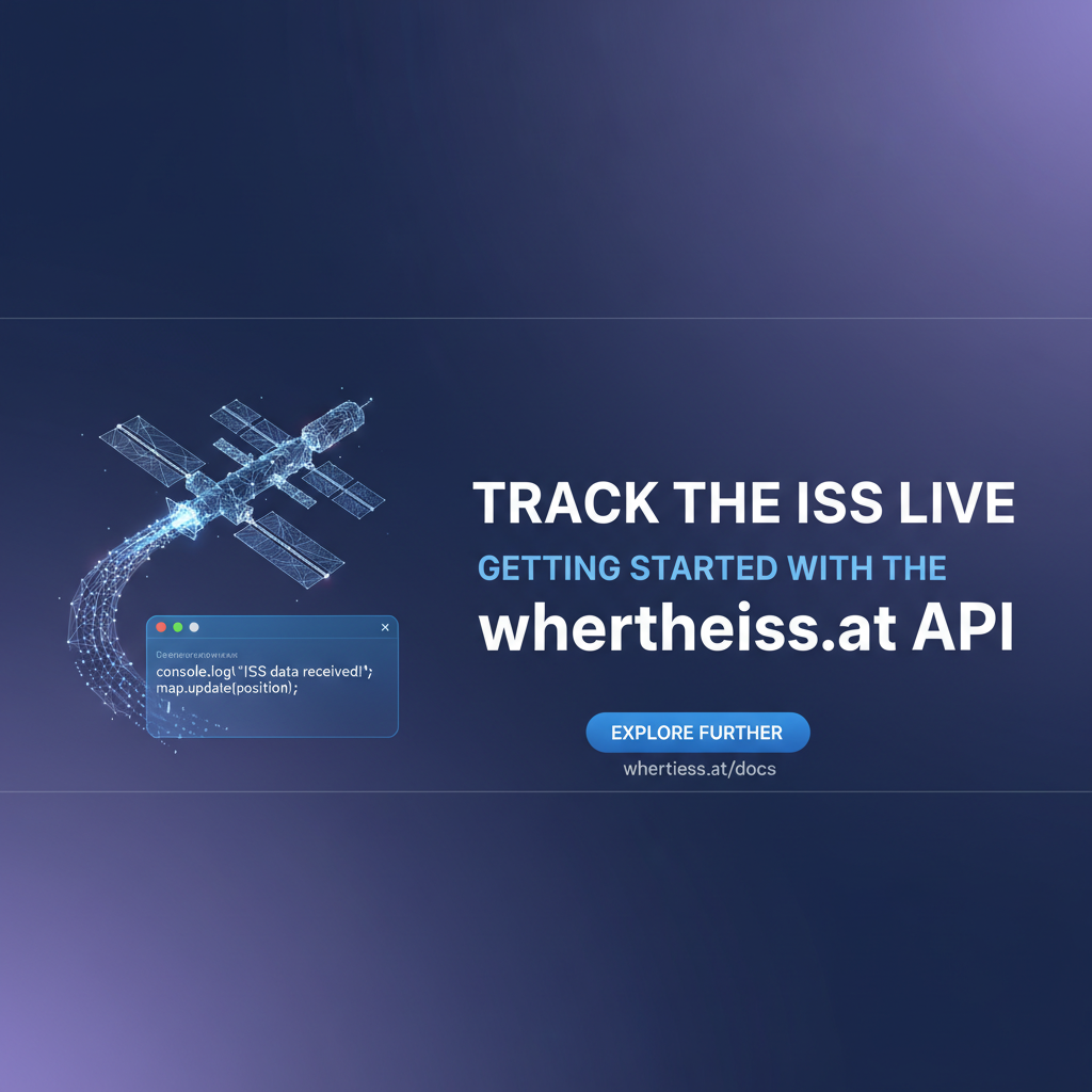
Track the ISS Live: Getting Started with the wheretheiss.at API


The vast expanse of space has captivated humanity for millennia, a boundless canvas for our imagination and a frontier for our exploration. Among the celestial dance of stars and planets, one man-made marvel stands as a testament to international collaboration and human ingenuity: the International Space Station (ISS). This orbiting laboratory, visible as a bright moving light across our night sky, is home to astronauts from around the globe, conducting groundbreaking research that benefits life on Earth and prepares us for deeper space missions. While watching the ISS traverse the heavens with the naked eye is a profoundly moving experience, knowing its precise location at any given moment adds another layer of wonder and practicality. How can we track this incredible feat of engineering, moving at speeds exceeding 17,000 miles per hour, as it circles our planet roughly every 90 minutes? The answer, like so much in our interconnected digital world, lies in the power of an API.
In this comprehensive guide, we embark on a journey to demystify the process of tracking the ISS live, focusing specifically on how to leverage the simple yet powerful open-notify.org API (which powers popular sites like wheretheiss.at). We'll delve into the foundational concepts of Application Programming Interfaces, explore the specific endpoints offered by this service, and provide step-by-step instructions and code examples to retrieve and interpret the ISS's real-time position data. Beyond just getting the numbers, we'll discuss how to transform this raw API data into meaningful insights, visualize it on a map, and even predict future passes over your specific location. This journey will not only equip you with the technical skills to interact with web services but also deepen your appreciation for the intricate dance between technology, space exploration, and human curiosity.
Understanding APIs: The Invisible Threads of the Digital World
Before we dive into the specifics of tracking the International Space Station, it's crucial to grasp the fundamental concept of an Application Programming Interface, or API. In simple terms, an API acts as a messenger that allows different software applications to communicate with each other. Imagine you're at a restaurant: you don't go into the kitchen to prepare your meal yourself. Instead, you look at the menu (which describes what's available), tell the waiter (the API) what you want, and the waiter takes your order to the kitchen, brings back your food, and delivers it to your table. You, the diner, don't need to know how the food is cooked; you just need to know how to order it.
Similarly, an API defines a set of rules and protocols by which software components can interact. It specifies how to request information or functionality from another piece of software (like a server or a database) and what kind of response to expect. Without APIs, the modern digital landscape as we know it would cease to exist. Every time you check the weather on your phone, see a social media feed refresh, use a payment gateway online, or book a flight, APIs are working tirelessly behind the scenes, connecting disparate systems and enabling seamless data exchange. They are the invisible threads that weave together the fabric of the internet, allowing services to share data and functionalities in a structured and efficient manner.
The beauty of APIs lies in their ability to abstract complexity. As a developer, you don't need to understand the intricate internal workings of a system to use its data or services. You just need to know its API specifications. This allows for rapid development, innovation, and the creation of highly integrated applications. For instance, a mapping application doesn't need to collect and maintain its own global map data; it can simply integrate with a mapping API provided by Google, Apple, or OpenStreetMap. A travel website doesn't need to connect individually to every airline's reservation system; it can use a travel API that aggregates data from multiple carriers. This modularity makes systems more robust, scalable, and easier to maintain.
There are various types of APIs, but one of the most prevalent and widely used types on the web is the RESTful API (Representational State Transfer). RESTful APIs are designed to be stateless, meaning each request from a client to a server contains all the information needed to understand the request, and the server doesn't store any client context between requests. They typically use standard HTTP methods like GET (to retrieve data), POST (to send data), PUT (to update data), and DELETE (to remove data). The data exchanged via RESTful APIs is most commonly formatted as JSON (JavaScript Object Notation) or XML (eXtensible Markup Language), with JSON being the dominant choice due to its lightweight nature and ease of parsing. The API we'll be using to track the ISS is a prime example of a simple, public, and RESTful API that returns data in JSON format, making it an excellent starting point for anyone new to API interactions.
The open-notify.org API: Your Gateway to ISS Tracking
The open-notify.org project provides a straightforward and free API for obtaining real-time information about the International Space Station. While many websites and applications, such as wheretheiss.at, visualize this data, they are essentially consuming the open-notify.org API behind the scenes. This makes open-notify.org an ideal candidate for our exploration, as it directly exposes the data we need in an easily digestible format. The API is designed with simplicity in mind, requiring no authentication, which makes it incredibly accessible for beginners and hobbyist developers.
The primary endpoint for tracking the ISS's current location is:
http://api.open-notify.org/iss-now.json
When you send a request to this Uniform Resource Locator (URL), the API server responds with a JSON object containing the current geographic coordinates (latitude and longitude) of the ISS, along with a timestamp indicating when this position was recorded. The data is updated very frequently, providing a near real-time snapshot of the station's trajectory. This simplicity is its strength; you don't need complex queries or elaborate configurations to get the most essential piece of information: where the ISS is right now.
Beyond its current location, the open-notify.org API also offers another valuable endpoint for predicting when the ISS will pass over a specific location on Earth. This is incredibly useful for those hoping to catch a glimpse of the station in the night sky. The endpoint for future pass predictions is:
http://api.open-notify.org/iss-pass.json
However, this endpoint requires additional parameters in the form of query strings to specify the latitude and longitude of the observer's location. For example:
http://api.open-notify.org/iss-pass.json?lat=34.05&lon=-118.25
Here, lat=34.05 represents a latitude of 34.05 degrees North, and lon=-118.25 represents a longitude of 118.25 degrees West (roughly Los Angeles, California). The API will then respond with a list of upcoming passes, each entry including the risetime (the Unix timestamp when the ISS becomes visible), duration (how long it will be visible in seconds), and sometimes other details relevant to its trajectory over that specific point. It's important to note that visibility depends on various factors including local time, weather conditions, and the station's altitude relative to the observer's horizon, but the API provides the core astronomical data needed to calculate these events.
The data returned by both endpoints is formatted as JSON. JSON, or JavaScript Object Notation, is a lightweight data-interchange format that is easy for humans to read and write, and easy for machines to parse and generate. It is built on two structures: 1. A collection of name/value pairs (like an object or dictionary in programming languages). 2. An ordered list of values (like an array).
For instance, a response from iss-now.json might look like this:
{
  "message": "success",
  "timestamp": 1678886400,
  "iss_position": {
    "latitude": "40.7128",
    "longitude": "-74.0060"
  }
}
Understanding this structure is key to extracting the desired information using any programming language. The "message": "success" indicates that the request was processed without issues. The "timestamp" field provides the time in Unix epoch format, which is the number of seconds that have elapsed since January 1, 1970 (UTC). The "iss_position" object then contains the "latitude" and "longitude" as strings. We will learn how to parse and utilize these values in the subsequent sections. The simplicity and open nature of the open-notify.org API make it an outstanding tool for learning about API consumption and for adding a dash of space-age wonder to your personal projects.
Step-by-Step Guide: Accessing the open-notify.org API
Interacting with an API might sound daunting, but with the right tools and a clear understanding of the process, it's a remarkably straightforward task. For the open-notify.org API, which is public and requires no authentication, getting started is even simpler. We will explore several methods, ranging from basic browser interaction to programmatic access using popular programming languages.
Prerequisites
Before we begin, ensure you have: * An internet connection. * A modern web browser (for the simplest method). * For command-line and programming methods: * A terminal or command prompt. * curl installed (usually pre-installed on Linux/macOS, available for Windows). * Python 3 installed with its package manager pip. * A code editor (e.g., VS Code, Sublime Text, Atom).
Method 1: Using a Web Browser (The Simplest Approach)
The easiest way to see the data from the open-notify.org API is by simply typing its URL into your web browser.
- Open your web browser: Launch Chrome, Firefox, Safari, Edge, or any other modern browser.
- Navigate to the API endpoint: In the address bar, type
http://api.open-notify.org/iss-now.jsonand press Enter.
What you'll see is a raw JSON response. Depending on your browser and any installed JSON viewing extensions, it might be plain text or a prettified, colored, and collapsible view.
{"timestamp": 1709420000, "iss_position": {"latitude": "51.4878", "longitude": "0.0000"}, "message": "success"}
This output immediately shows you the three key pieces of information: * timestamp: The exact time (in Unix epoch seconds) when the ISS was at this position. * iss_position: An object containing latitude and longitude as strings. * message: Indicates if the API request was successful.
This method is great for a quick check or to visually inspect the data structure, but it's not practical for building dynamic applications.
Method 2: Using curl (Command Line Utility)
curl is a versatile command-line tool for transferring data with URLs. It's an excellent way to interact with APIs without writing a full program.
- Open your terminal/command prompt:
- On macOS or Linux, open the Terminal application.
- On Windows, open PowerShell or Command Prompt.
- Execute the
curlcommand: Type the following command and press Enter:bash curl http://api.open-notify.org/iss-now.jsonYou will see the same JSON output as in the browser, but it will be printed directly to your console. For better readability, you can pipe the output to a JSON pretty-printer if you have one (e.g.,jqon Linux/macOS):bash curl http://api.open-notify.org/iss-now.json | jq .Ifjqis not installed, the raw output is still perfectly understandable. This method is crucial for scripting and testing API endpoints during development.
Method 3: Using Python (Programmatic Access)
Python is a popular choice for API interaction due to its simplicity and powerful libraries. We'll use the requests library, which simplifies making HTTP requests.
- Install
requests: If you don't have it, open your terminal and run:bash pip install requests - Create a Python script: Open your code editor and create a file named
iss_tracker.py. - Run the script: In your terminal, navigate to the directory where you saved
iss_tracker.pyand run:bash python iss_tracker.pyThe script will output the current position of the ISS and a list of upcoming passes over the specified latitude and longitude. This Python example demonstrates robust API interaction, including error handling, data parsing, and practical data transformation (Unix timestamp to human-readable).
Write the Python code:```python import requests import json from datetime import datetime
The API endpoint for ISS current location
API_URL = "http://api.open-notify.org/iss-now.json"print(f"Fetching ISS data from: {API_URL}")try: # Make a GET request to the API response = requests.get(API_URL)
# Check if the request was successful (status code 200)
response.raise_for_status() # Raises an HTTPError for bad responses (4xx or 5xx)

# Parse the JSON response
data = response.json()

# Extract relevant information
message = data.get("message")
timestamp_unix = data.get("timestamp")
iss_position = data.get("iss_position")

if message == "success" and iss_position:
    latitude = iss_position.get("latitude")
    longitude = iss_position.get("longitude")

    # Convert Unix timestamp to human-readable date and time
    # Note: Unix timestamp is typically in seconds. datetime.fromtimestamp expects seconds.
    timestamp_human = datetime.fromtimestamp(timestamp_unix).strftime('%Y-%m-%d %H:%M:%S UTC')

    print("\n--- ISS Current Position ---")
    print(f"Timestamp: {timestamp_human}")
    print(f"Latitude: {latitude}°")
    print(f"Longitude: {longitude}°")
    print("----------------------------")
    print(f"Source API: {API_URL}")
else:
    print(f"Error: API response message was '{message}' or position data missing.")
    print(f"Full response: {json.dumps(data, indent=2)}")
except requests.exceptions.RequestException as e: print(f"An error occurred while making the API request: {e}") except json.JSONDecodeError: print("Error: Could not decode JSON response from the API.") print(f"Raw response text: {response.text}") except Exception as e: print(f"An unexpected error occurred: {e}")
--- Demonstrating ISS Pass Times ---
This requires specific latitude and longitude
MY_LATITUDE = 34.0522 # Example: Los Angeles, CA MY_LONGITUDE = -118.2437 # Example: Los Angeles, CA PASS_API_URL = f"http://api.open-notify.org/iss-pass.json?lat={MY_LATITUDE}&lon={MY_LONGITUDE}"print(f"\nFetching ISS pass times for Lat: {MY_LATITUDE}, Lon: {MY_LONGITUDE}") print(f"From API: {PASS_API_URL}")try: response_pass = requests.get(PASS_API_URL) response_pass.raise_for_status() pass_data = response_pass.json()
pass_message = pass_data.get("message")
request_details = pass_data.get("request")
pass_times = pass_data.get("response")

if pass_message == "success" and pass_times:
    print("\n--- Upcoming ISS Passes ---")
    print(f"Location Requested: Lat={request_details.get('latitude')}, Lon={request_details.get('longitude')}, Alt={request_details.get('altitude')}m")
    print(f"Number of Passes: {len(pass_times)}")
    print("----------------------------")
    for i, p in enumerate(pass_times):
        risetime_unix = p.get("risetime")
        duration_seconds = p.get("duration")

        risetime_human = datetime.fromtimestamp(risetime_unix).strftime('%Y-%m-%d %H:%M:%S UTC')
        print(f"Pass {i+1}:")
        print(f"  Risetime: {risetime_human}")
        print(f"  Duration: {duration_seconds} seconds")
    print("----------------------------")
else:
    print(f"Error: API pass response message was '{pass_message}' or pass data missing.")
    print(f"Full response: {json.dumps(pass_data, indent=2)}")
except requests.exceptions.RequestException as e: print(f"An error occurred while making the ISS pass API request: {e}") except json.JSONDecodeError: print("Error: Could not decode JSON response from the ISS pass API.") print(f"Raw response text: {response_pass.text}") except Exception as e: print(f"An unexpected error occurred during pass fetching: {e}") ```
Method 4: Using JavaScript (for Web Applications)
JavaScript is essential for building interactive web applications. The modern fetch API makes network requests straightforward in browsers and Node.js.
- Create an HTML file: Open your code editor and create a file named
iss_web_tracker.html. - Open in Browser: Save
iss_web_tracker.htmland open it with your web browser. You'll see the live ISS position and upcoming passes dynamically updated on the page.
Write the HTML and JavaScript:```html <!DOCTYPE html>Live ISS Tracker
Live International Space Station Tracker
Last Updated: Loading...Latitude: Loading...Longitude: Loading...Refresh ISS Position
    <h2 style="margin-top: 40px; text-align: center; color: #0056b3;">Upcoming Passes Over My Location</h2>
    <p style="text-align: center; font-size: 0.9em; color: #555;">(Using placeholder Lat: 34.05, Lon: -118.25 - Los Angeles)</p>
    <div id="iss-passes" class="pass-list">
        <!-- Pass times will be loaded here -->
        <p style="text-align: center;">Loading pass predictions...</p>
    </div>
</div>

<script>
    const API_ISS_NOW = "http://api.open-notify.org/iss-now.json";
    // Example: Los Angeles coordinates
    const MY_LAT = 34.0522;
    const MY_LON = -118.2437;
    const API_ISS_PASS = `http://api.open-notify.org/iss-pass.json?lat=${MY_LAT}&lon=${MY_LON}`;

    function updateStatus(message, isError = false) {
        const statusElement = document.getElementById('status');
        statusElement.textContent = message;
        statusElement.style.color = isError ? 'red' : '#666';
    }

    async function fetchIssData() {
        updateStatus('Fetching current ISS data...', false);
        try {
            const response = await fetch(API_ISS_NOW);
            if (!response.ok) {
                throw new Error(`HTTP error! status: ${response.status}`);
            }
            const data = await response.json();

            if (data.message === "success") {
                const latitude = data.iss_position.latitude;
                const longitude = data.iss_position.longitude;
                const timestamp = new Date(data.timestamp * 1000).toUTCString(); // Convert Unix timestamp to milliseconds

                document.getElementById('timestamp').textContent = timestamp;
                document.getElementById('latitude').textContent = latitude + '°';
                document.getElementById('longitude').textContent = longitude + '°';
                updateStatus('ISS position updated successfully.', false);
            } else {
                updateStatus(`Error: ${data.message}`, true);
            }
        } catch (error) {
            updateStatus(`Failed to fetch ISS position: ${error.message}`, true);
            console.error("Error fetching ISS position:", error);
        }
    }

    async function fetchIssPasses() {
        const passListElement = document.getElementById('iss-passes');
        passListElement.innerHTML = '<p style="text-align: center;">Fetching pass predictions...</p>'; // Clear previous messages
        try {
            const response = await fetch(API_ISS_PASS);
            if (!response.ok) {
                throw new Error(`HTTP error! status: ${response.status}`);
            }
            const data = await response.json();

            if (data.message === "success" && data.response && data.response.length > 0) {
                passListElement.innerHTML = ''; // Clear loading message
                data.response.forEach((pass, index) => {
                    const risetime = new Date(pass.risetime * 1000).toUTCString();
                    const duration = pass.duration; // seconds
                    const passItem = document.createElement('div');
                    passItem.className = 'pass-item';
                    passItem.innerHTML = `
                        <strong>Pass ${index + 1}:</strong><br>
                        Risetime: ${risetime}<br>
                        Duration: ${duration} seconds
                    `;
                    passListElement.appendChild(passItem);
                });
                updateStatus('ISS pass predictions loaded.', false);
            } else if (data.message === "success" && data.response && data.response.length === 0) {
                passListElement.innerHTML = '<p style="text-align: center;">No upcoming passes found for this location.</p>';
                updateStatus('No upcoming passes found.', false);
            }
            else {
                passListElement.innerHTML = `<p style="text-align: center; color: red;">Error: ${data.message}</p>`;
                updateStatus(`Error: ${data.message}`, true);
            }
        } catch (error) {
            passListElement.innerHTML = `<p style="text-align: center; color: red;">Failed to fetch pass predictions: ${error.message}</p>`;
            updateStatus(`Failed to fetch pass predictions: ${error.message}`, true);
            console.error("Error fetching ISS passes:", error);
        }
    }

    // Initial data fetch when the page loads
    document.addEventListener('DOMContentLoaded', () => {
        fetchIssData();
        fetchIssPasses();
        // Optionally refresh ISS position every 10 seconds
        setInterval(fetchIssData, 10000);
    });
</script>
```
This JavaScript example highlights how APIs are integrated into client-side web applications, bringing dynamic content and real-time data to users. As you delve deeper into consuming and managing various APIs, especially when integrating multiple services or AI models into more complex applications, tools like APIPark become invaluable. APIPark offers an open-source AI gateway and API management platform that simplifies integrating and deploying diverse services, providing a unified approach to API lifecycle management and ensuring efficient, secure interactions, which is crucial when dealing with a multitude of data sources and service endpoints.
These four methods provide a progressive path from basic API inspection to full programmatic control, demonstrating the versatility and accessibility of the open-notify.org API for tracking the International Space Station. Each method serves a different purpose, allowing you to choose the approach best suited for your needs, whether it's a quick check or building a sophisticated application.
APIPark is a high-performance AI gateway that allows you to securely access the most comprehensive LLM APIs globally on the APIPark platform, including OpenAI, Anthropic, Mistral, Llama2, Google Gemini, and more.Try APIPark now! 👇👇👇
Interpreting the Data: What Those Numbers Mean
Once you've successfully retrieved data from the open-notify.org API, the next crucial step is to understand what the numbers and strings within the JSON response actually represent. This interpretation is vital for translating raw API output into meaningful information, whether you're displaying it to a user, storing it in a database, or performing further calculations.
Let's revisit the typical JSON response from the iss-now.json endpoint:
{
  "message": "success",
  "timestamp": 1709420000,
  "iss_position": {
    "latitude": "51.4878",
    "longitude": "0.0000"
  }
}
message: "success" or Error Status
The "message" field is a simple status indicator. A value of "success" means that the API request was processed correctly, and the data you requested is included in the response. If there were an issue (e.g., an invalid request for other endpoints, or a server error), this field would contain an error message, and the other data fields might be absent or incomplete. Always check this field first in your code to ensure you're working with valid data.
timestamp: The Pulse of Time
The "timestamp" field is a crucial piece of data, representing the exact moment (in Coordinated Universal Time, UTC) when the ISS was at the reported iss_position. The value, 1709420000 in our example, is a Unix epoch timestamp. This is the number of seconds that have elapsed since the Unix epoch (January 1, 1970, at 00:00:00 UTC).
While computers handle Unix timestamps with ease, humans prefer dates and times in a more readable format. Most programming languages provide functions to convert Unix timestamps into human-readable date and time strings. As seen in the Python and JavaScript examples, this conversion is essential for presenting the data effectively to users. For instance, 1709420000 translates to 2024-03-02 12:53:20 UTC. This conversion allows you to display, for example, "Last Updated: 2024-03-02 at 12:53:20 UTC," providing immediate context for the ISS's position. It's important to remember that this timestamp represents the UTC time, and you might need to convert it to a local time zone if your application requires it.
iss_position: Pinpointing the ISS on Earth
The "iss_position" object contains the spatial coordinates that tell us exactly where the International Space Station is above Earth's surface.
latitude: This value indicates how far North or South the ISS is from the Equator. Latitude ranges from -90 degrees (South Pole) to +90 degrees (North Pole). A positive value means North, and a negative value means South. In our example,51.4878degrees North places the ISS over Europe or North America, depending on longitude.longitude: This value indicates how far East or West the ISS is from the Prime Meridian (which passes through Greenwich, London). Longitude ranges from -180 degrees (West) to +180 degrees (East). A positive value means East, and a negative value means West. Our example's0.0000degrees longitude places the ISS precisely over the Prime Meridian.
Together, latitude and longitude form a unique pair of coordinates that can precisely locate any point on the Earth's surface. These are the fundamental values you'll use to plot the ISS on a map, track its path, or determine its position relative to a specific city or country. The fact that these are provided as strings ("51.4878") instead of numbers in the JSON is a common design choice for APIs; you'll typically convert them to floating-point numbers in your programming language for calculations or mapping functions.
Interpreting ISS Pass Times
When querying the iss-pass.json endpoint, the response structure is slightly different but equally straightforward:
{
  "message": "success",
  "request": {
    "altitude": 100,
    "datetime": 1709420000,
    "latitude": 34.05,
    "longitude": -118.25
  },
  "response": [
    {
      "duration": 546,
      "risetime": 1709452800
    },
    {
      "duration": 640,
      "risetime": 1709458000
    }
  ]
}
request: This object simply echoes back the parameters you sent in your API call (latitude, longitude, and potentially altitude and a datetime). This is helpful for confirming that the API processed your request as intended.response: This is an array of objects, where each object represents an upcoming pass of the ISS over your specified location.duration: This integer indicates how long (in seconds) the ISS will be visible in the sky for that particular pass. A longer duration means a better viewing opportunity.risetime: Similar to thetimestampfor the current position, this is a Unix epoch timestamp indicating when the ISS will first become visible above the horizon for that pass. Again, this needs to be converted to a human-readable format.
By interpreting these values, you can inform users exactly when and for how long they can expect to see the ISS. For example, a risetime of 1709452800 (which is 2024-03-02 21:20:00 UTC) and a duration of 546 seconds (9 minutes, 6 seconds) means the ISS will become visible at 9:20 PM UTC and remain visible for just over 9 minutes. This data, combined with local weather forecasts and clear skies, empowers astronomy enthusiasts to plan their viewing sessions perfectly. The ability to precisely interpret API data is a fundamental skill for any developer looking to build applications that leverage external services.
Beyond the Basics: Advanced Applications and Integrations
Accessing and interpreting the raw data from the open-notify.org API is a fantastic start, but the true power of this information unfolds when you integrate it into more sophisticated applications. Moving beyond simple text output, we can create visually rich, interactive, and highly functional tools. This section explores how to take your ISS tracking project to the next level by visualizing the data and combining it with other APIs.
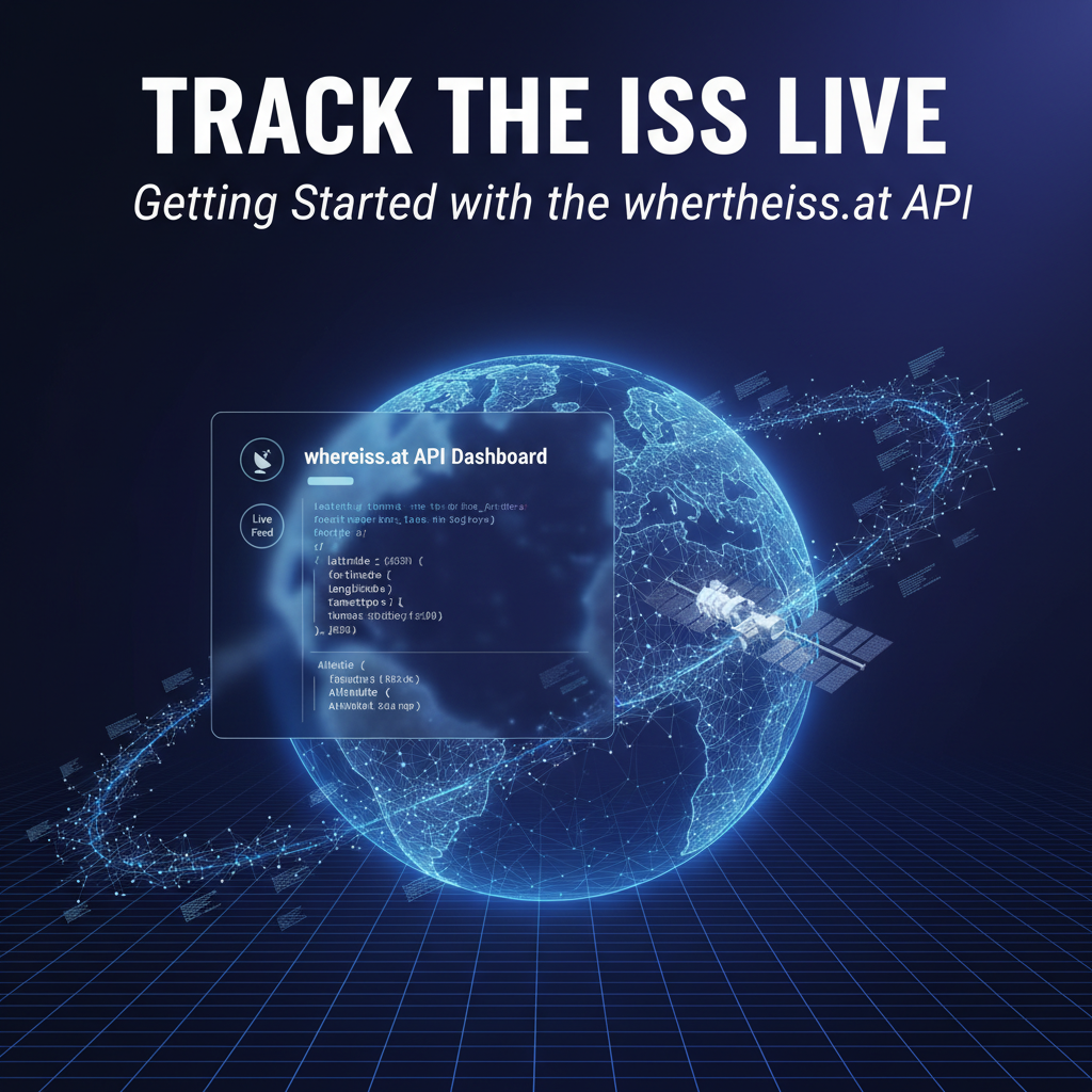
Visualizing on a Map: Bringing the ISS to Life
Seeing latitude and longitude coordinates is informative, but plotting them on a map makes the ISS's journey tangible. Modern web mapping APIs, like Google Maps Platform, OpenStreetMap with Leaflet.js, or Mapbox, provide powerful tools to display geographic data.
- Choosing a Mapping API:
- Google Maps API: Offers robust features, satellite imagery, and comprehensive documentation. Requires an API key and can incur costs for high usage.
- Leaflet.js with OpenStreetMap: A lightweight, open-source JavaScript library that works well with OpenStreetMap data (which is free). Excellent for simpler, custom map applications without immediate cost concerns.
- Mapbox: Provides highly customizable maps and design tools, with a generous free tier for developers.
- Basic Map Integration (using Leaflet.js as an example):
- HTML Structure: Include Leaflet's CSS and JavaScript files in your HTML.
- Initialize Map: Create a
divelement for your map and initialize Leaflet with specific center coordinates and zoom level. - Add a Marker: Use the ISS's latitude and longitude from the
open-notify.orgAPI to create a marker on the map. - Dynamic Updates: Implement a JavaScript
setIntervalfunction to periodically fetch new ISS data and update the marker's position on the map, creating a live tracking experience. You can even draw a polyline to show the path the ISS has taken over the last few minutes or project its immediate future trajectory.
This visualization transforms abstract numbers into an engaging, real-time representation, allowing users to intuitively grasp where the ISS is relative to their own location or any other point on the globe. Seeing the ISS move across continents on a map is a powerful educational tool and a fascinating personal project.
Predicting ISS Passes: Never Miss a Sighting
The iss-pass.json endpoint is invaluable for predicting when the ISS will be visible from a specific ground location. While the API provides the raw risetime and duration, you can enhance this functionality in your application:
- User Input for Location: Allow users to input their own latitude and longitude (or use browser geolocation APIs to automatically detect their position) to personalize the pass predictions.
- Timezone Conversion: The API returns
risetimein UTC. For user convenience, convert this to the user's local timezone. - Filtering and Sorting: If the API returns many passes, you might want to filter for the nearest ones or sort them chronologically.
- Notifications: Integrate with notification APIs (e.g., Twilio for SMS, SendGrid for email, or browser push notifications) to alert users shortly before an upcoming pass. Imagine getting a text message 15 minutes before the ISS flies over your house! This requires a more complex backend or serverless functions to handle scheduling and sending notifications.
Combining with Other APIs: Building Richer Experiences
The true power of APIs lies in their composability. By combining the open-notify.org API with other services, you can create even richer and more informative applications.
- Weather APIs: Before a scheduled ISS pass, it's useful to know if the sky will be clear. Integrate with a weather API (e.g., OpenWeatherMap, AccuWeather) to fetch local cloud cover forecasts. You could then advise users whether it's worth going outside to look.
- Geolocation/Geocoding APIs: Instead of requiring users to input precise latitude/longitude, allow them to type in a city name. A geocoding API (like Google Geocoding API or OpenStreetMap Nominatim) can convert the city name into coordinates, which you can then pass to the
iss-pass.jsonAPI. - Orbital Data APIs: For advanced users or educational purposes, you might want to display more detailed orbital elements. While
open-notify.orgdoesn't provide TLE (Two-Line Element) data, other specialized satellite tracking APIs do. This data can be used to calculate orbital paths with higher precision and visualize them in 3D. - Astronomical Event APIs: Combine ISS pass predictions with other celestial events (e.g., meteor showers, planetary alignments) to create a comprehensive astronomical calendar.
Integrating multiple APIs, managing their authentication, ensuring data consistency, and handling potential rate limits can quickly become complex. This is where advanced API management platforms truly shine. For organizations or projects dealing with a diverse ecosystem of services—be they public data APIs, internal business APIs, or cutting-edge AI model APIs—a centralized management solution is critical. Platforms like APIPark provide an open-source AI gateway and API management platform that helps orchestrate these interactions. It enables seamless integration of 100+ AI models, unifies API formats for invocation, and provides end-to-end lifecycle management, making it much easier to design, deploy, and monitor complex API architectures. From performance rivaling traditional proxies to detailed call logging and powerful data analysis, such platforms ensure that even the most ambitious API-driven applications run smoothly and securely. This type of infrastructure becomes indispensable as your projects grow in scope and complexity, transforming a collection of individual API calls into a coherent, managed system.
Challenges and Considerations
While the open-notify.org API offers a wonderfully simple entry point into the world of API interaction, any real-world application development requires an understanding of common challenges and best practices. Anticipating and addressing these considerations will lead to more robust, reliable, and user-friendly applications.
Rate Limiting: Respecting API Boundaries
Many public APIs, including open-notify.org, implement rate limiting. This mechanism restricts the number of requests a user or an IP address can make within a certain timeframe (e.g., 1,000 requests per hour). The purpose of rate limiting is to prevent abuse, ensure fair usage among all consumers, and protect the API servers from being overloaded.
- Understanding Limits: Always check an API's documentation for its specific rate limits. While
open-notify.orgis quite lenient foriss-now.json(allowing many requests per minute), more complex APIs or those requiring authentication often have stricter limits. - Implementing Delays: If you need to make frequent requests, build in delays between calls (e.g., using
time.sleep()in Python orsetTimeout()in JavaScript). - Caching Data: For data that doesn't change rapidly (e.g., ISS passes for a day), fetch it once and cache it locally for a period instead of repeatedly querying the API.
- Handling
429 Too Many Requests: Your application should be designed to gracefully handle a429HTTP status code. This usually means pausing requests for a short period and then retrying.
Error Handling: Building Resilient Applications
Real-world API interactions are not always perfect. Network issues, server problems, or invalid requests can lead to errors. Robust error handling is paramount for creating a stable application.
- HTTP Status Codes: Always check the HTTP status code of the API response.
200 OK: Success!400 Bad Request: Your request was malformed (e.g., missing parameters foriss-pass.json).404 Not Found: The specific endpoint or resource doesn't exist.500 Internal Server Error: An issue on the API server's side.429 Too Many Requests: Rate limit exceeded.
- JSON Parsing Errors: Ensure your code can handle cases where the API might return non-JSON data or malformed JSON, perhaps due to an error on their end.
- Network Issues: Your application should account for network outages or slow connections that prevent the API request from even reaching the server. This often involves
try-exceptblocks (Python) ortry-catchblocks (JavaScript) around your API calls. - Informative Feedback: When an error occurs, provide clear and helpful feedback to the user or log detailed information for debugging.
Data Accuracy and Delays: Real-time vs. Near Real-time
While the open-notify.org API provides near real-time data, it's important to understand that there will always be a minuscule delay between the ISS's actual position and the data reported by the API.
- Processing Latency: Data needs to be collected, processed, and then served by the API. This involves a series of steps that introduce minor latency.
- Update Frequency: The API itself might update its internal data source every few seconds or minutes. For the ISS, this is usually frequent enough for practical purposes, but it's not truly instantaneous.
- Impact: For most ISS tracking applications, these minor delays are negligible. However, for highly sensitive scientific or navigational applications, more direct and high-frequency data sources might be required.
Security: Beyond Public APIs
The open-notify.org API is public and requires no authentication, making it very easy to use. However, when working with other APIs, security becomes a primary concern.
- API Keys: Many APIs require an API key, a unique string that identifies your application and authenticates your requests. Never hardcode API keys directly into client-side JavaScript or publicly accessible code. Use environment variables or secure backend servers to store and manage them.
- OAuth: For APIs that access user data, OAuth 2.0 is a common protocol for secure authorization, allowing users to grant your application limited access to their data without sharing their credentials directly.
- Data Encryption (HTTPS): Always use HTTPS when interacting with APIs to encrypt data in transit, protecting it from eavesdropping and tampering. The
open-notify.orgAPI supports HTTPS, although the HTTP link also works. - Input Validation: When sending data to an API (even query parameters for
iss-pass.json), always validate and sanitize user input to prevent injection attacks or malformed requests.
Scalability: Designing for Growth
If your ISS tracker application becomes popular, you'll need to consider how it handles increased user load and data demands.
- Efficient Code: Write optimized code that minimizes resource consumption.
- Backend Infrastructure: For complex applications, consider moving heavy data processing, notifications, and API key management to a dedicated backend server or serverless functions.
- Database Caching: Store frequently accessed API data in a database to reduce the number of direct API calls, especially for data that changes slowly.
- Load Balancing: If you're running multiple instances of your application, use load balancers to distribute traffic evenly.
- API Management Platforms: As highlighted earlier, for robust scaling and managing a complex API ecosystem, platforms like APIPark become crucial. They offer features like traffic forwarding, load balancing, API versioning, and performance monitoring, which are essential for supporting large-scale traffic and ensuring high availability.
By meticulously considering these challenges, developers can transform a basic API interaction into a resilient, scalable, and secure application that effectively serves its users and respects the integrity of the API services it consumes.
Conclusion: Bridging Earth and Orbit Through the Power of APIs
Our journey through tracking the International Space Station live has underscored a fundamental truth of the digital age: the world is increasingly connected and powered by Application Programming Interfaces. From the initial spark of curiosity about humanity's orbital outpost to the practical steps of fetching and interpreting its real-time position, we've seen how a simple, open-source API can democratize access to fascinating data, transforming complex aerospace telemetry into readily consumable information for developers and enthusiasts alike.
We started by dissecting the very essence of an API, understanding its role as a universal translator between diverse software systems. This foundational knowledge proved indispensable as we then delved into the specifics of the open-notify.org API, highlighting its key endpoints for current ISS location and future pass predictions. Through hands-on examples using web browsers, command-line tools like curl, and programming languages such as Python and JavaScript, we demonstrated how to retrieve, parse, and utilize this valuable data effectively. The process revealed that interacting with an API is not just a technical task but an act of discovery, allowing us to connect with a moving target hundreds of kilometers above us.
Beyond the basic data retrieval, we explored the exciting possibilities of advanced applications. Visualizing the ISS on a dynamic map elevates the tracking experience from a list of coordinates to an interactive, global journey. Combining the ISS data with other APIs—such as those for weather forecasts or geocoding—unlocks a new realm of personalized and intelligent services, from predicting optimal viewing conditions to sending timely notifications. This modularity and composability are the hallmarks of modern software development, where diverse services are woven together to create powerful new tools.
However, with great power comes the responsibility to understand and mitigate potential challenges. We've discussed the critical importance of respecting API rate limits, implementing robust error handling, appreciating the nuances of data accuracy, and considering security and scalability. These are not merely technical footnotes but essential considerations for building reliable and sustainable applications that can stand the test of time and user demand. For projects requiring sophisticated API management, especially when integrating a multitude of services and AI models, platforms like APIPark emerge as indispensable tools, providing the governance, performance, and insights needed to orchestrate complex API ecosystems effectively.
Ultimately, tracking the ISS live with an API is more than just a coding exercise; it's a profound reminder of human ingenuity, our collective push into the cosmos, and the remarkable ways technology allows us to engage with these grand endeavors. It invites us to experiment, to build, and to marvel at the digital bridges that connect our terrestrial lives to the boundless reaches of space. Whether you're a seasoned developer or a curious beginner, the open-notify.org API offers an accessible and rewarding entry point into the vast and exciting world of APIs, encouraging you to explore, innovate, and perhaps even inspire the next generation of space enthusiasts and programmers.
Frequently Asked Questions (FAQs)
1. What is an API and how does it relate to tracking the ISS? An API (Application Programming Interface) is a set of rules and protocols that allows different software applications to communicate and share data. In the context of tracking the ISS, an API (specifically the open-notify.org API) provides a structured way to request and receive real-time information about the International Space Station's location (latitude, longitude, and timestamp) from a server. Websites and applications like wheretheiss.at use this API to display the ISS's position.
2. Is the open-notify.org API free to use? Yes, the open-notify.org API for tracking the ISS and its pass predictions is free and publicly accessible, requiring no authentication. This makes it an excellent resource for learning about API interactions and building personal projects without incurring costs. Like many public APIs, it does have reasonable rate limits to ensure fair usage.
3. How accurate is the ISS position data provided by the API? The open-notify.org API provides near real-time data. The position data (latitude and longitude) is generally very accurate for practical tracking purposes, with minimal latency between the ISS's actual position and the data reported. However, like all data streamed over the internet, there will be a tiny delay due to data collection, processing, and network transmission. For most applications, this level of accuracy is more than sufficient.
4. Can I predict when the ISS will pass over my location using this API? Yes, the open-notify.org API provides an endpoint (http://api.open-notify.org/iss-pass.json) that can predict upcoming ISS passes over a specific geographic location. You need to provide your latitude and longitude as parameters in the API request. The API then returns a list of future pass events, including the risetime (when the ISS becomes visible) and duration (how long it will be visible), both expressed as Unix timestamps and seconds, respectively.
5. What programming languages are best suited for interacting with APIs like open-notify.org? Many programming languages are well-suited for interacting with RESTful APIs. Python is a very popular choice due to its simplicity and powerful requests library, making it easy to send HTTP requests and parse JSON responses. JavaScript, with its built-in fetch API (or the older XMLHttpRequest), is ideal for web-based applications that need to display dynamic data in a browser. Other languages like Ruby, Java, C#, and Go also have excellent libraries and frameworks for API consumption, offering flexibility based on your project requirements and development environment.
🚀You can securely and efficiently call the OpenAI API on APIPark in just two steps:
Step 1: Deploy the APIPark AI gateway in 5 minutes.
APIPark is developed based on Golang, offering strong product performance and low development and maintenance costs. You can deploy APIPark with a single command line.
curl -sSO https://download.apipark.com/install/quick-start.sh; bash quick-start.sh

In my experience, you can see the successful deployment interface within 5 to 10 minutes. Then, you can log in to APIPark using your account.

Step 2: Call the OpenAI API.