How to Use the wheretheiss.at API: ISS Data Guide


The International Space Station (ISS) stands as a monumental testament to human ingenuity, international collaboration, and our enduring quest to explore the cosmos. Circling Earth roughly every 90 minutes, it serves as a unique microgravity laboratory, a platform for observing our planet, and a stepping stone for future deep-space missions. For many, its mere presence overhead, visible as a bright moving star, sparks wonder and curiosity. But beyond the naked eye, a wealth of real-time data about the ISS – its exact location, altitude, speed, and even the crew on board – is openly available, transforming it from a distant point of light into an interactive, data-rich entity.
In an increasingly interconnected world, the ability to access and utilize this kind of dynamic information is largely facilitated by Application Programming Interfaces, or apis. These powerful interfaces act as digital bridges, allowing different software applications to communicate and share data seamlessly. For anyone interested in the ISS, whether for educational purposes, personal tracking projects, or even complex data analysis, understanding how to tap into these data streams is the first exciting step. This extensive guide will delve deep into one of the most popular and straightforward apis for tracking the ISS: wheretheiss.at. We will explore its functionalities, walk through practical implementation examples, discuss best practices, and uncover the vast potential for creativity and innovation it unlocks. By the end of this journey, you'll not only know where the ISS is at any given moment but also possess the skills to build your own applications to harness this fascinating stream of space data.
The International Space Station: A Beacon of Human Endeavor and Open Data
Before we dive into the technicalities of data retrieval, it's worth pausing to appreciate the object of our fascination: the International Space Station. Orbiting approximately 400 kilometers (250 miles) above Earth, the ISS is a continuously inhabited outpost, a collaborative project involving five participating space agencies: NASA (United States), Roscosmos (Russia), JAXA (Japan), ESA (Europe), and CSA (Canada). Since its first component launched in 1998, it has grown into a complex assembly of modules, trusses, and solar arrays, roughly the size of an American football field.
The primary mission of the ISS is scientific research in a microgravity environment. Astronauts on board conduct experiments across a vast array of disciplines, including biology, human physiology, physics, astronomy, meteorology, and materials science. These experiments contribute to our understanding of life in space, develop new technologies, and improve life on Earth. Beyond its scientific output, the ISS also plays a crucial role in preparing for future human exploration missions to the Moon and Mars, testing systems and procedures in a long-duration spaceflight environment.
Given its public funding and its role as a global scientific asset, much of the data generated by or pertaining to the ISS is made publicly available. This commitment to open data aligns with a broader trend in scientific communities and government agencies to share information transparently, fostering innovation, education, and public engagement. For instance, NASA provides vast datasets, including images, videos, and telemetry. One of the most common and immediate pieces of information people seek is the station's current location – where exactly it is above the Earth at any given moment, and who is currently on board. This is precisely the kind of accessible, real-time data that apis are designed to deliver.
Introducing the wheretheiss.at API: Your Gateway to ISS Data
In the vast landscape of apis, wheretheiss.at stands out as a wonderfully accessible and user-friendly entry point for anyone wishing to interact with real-time ISS data. It provides a simple, unauthenticated RESTful api that delivers two primary pieces of information: the current geographical coordinates of the ISS and a list of astronauts currently on board. This simplicity, coupled with its reliability, has made it a favorite among developers, educators, and space enthusiasts alike.
The brilliance of wheretheiss.at lies in its directness. Unlike some more complex apis that require authentication keys, intricate request headers, or convoluted query parameters, wheretheiss.at adheres to a minimalist design philosophy. You simply send a standard HTTP GET request to a specific URL, and the api responds with the requested data in a clear, easy-to-parse JSON format. This "no-fuss" approach significantly lowers the barrier to entry, making it an excellent learning tool for those new to apis while still being robust enough for a variety of practical applications.
The underlying data for the ISS's position typically originates from publicly available NORAD (North American Aerospace Defense Command) Two-Line Element (TLE) sets, which are standard formats for describing the orbits of satellites. These TLEs are mathematical models that allow for the precise calculation of a satellite's position at any given time. wheretheiss.at abstracts away this complexity, performing the necessary calculations on its servers and presenting the derived latitude and longitude coordinates in a readily consumable format. This simplification is a prime example of the power of an api: it provides a service, handling the intricate backend processes so that users can focus on integrating and utilizing the data.
The broad utility of apis, exemplified by wheretheiss.at, extends far beyond merely tracking satellites. From fetching weather forecasts and stock prices to managing e-commerce transactions and integrating AI models into applications, apis are the invisible backbone of the modern digital world. They enable disparate systems to communicate, foster interoperability, and accelerate innovation by allowing developers to build upon existing services rather than reinventing every component from scratch.
Getting Started: Understanding RESTful APIs and the wheretheiss.at Endpoints
To effectively utilize wheretheiss.at or any other api, it's essential to grasp the fundamental concepts of RESTful apis. REST (Representational State Transfer) is an architectural style for designing networked applications. It emphasizes a stateless client-server interaction, where the server doesn't store any client context between requests. Each request from a client to the server must contain all the information necessary to understand the request.
Key characteristics of a RESTful api:
- Resources: Everything is a resource. In our case, the "current ISS location" and "people on board" are resources. Each resource has a unique identifier, typically a URL.
- Statelessness: Each request from the client to the server must contain all the information needed to understand the request. The server will not store any client context between requests.
- Methods: Standard HTTP methods (GET, POST, PUT, DELETE) are used to perform actions on resources. For
wheretheiss.at, we primarily use GET, which is for retrieving data. - Representations: Resources are represented in various formats, most commonly JSON (JavaScript Object Notation) or XML.
wheretheiss.atuses JSON, which is lightweight and easily readable by both humans and machines.
The Main Endpoint: Current ISS Location (/v1/satellites/25544)
The most frequently used endpoint for wheretheiss.at is the one that provides the current geographical coordinates and other orbital parameters of the ISS. The ISS is identified by NORAD ID 25544, a unique numerical identifier assigned to it by NORAD.
Endpoint URL: https://api.wheretheiss.at/v1/satellites/25544
To retrieve data from this endpoint, you simply make an HTTP GET request to this URL.
Example API Call using curl:
curl is a command-line tool and library for transferring data with URLs. It's an excellent way to test apis quickly without writing any code.
curl https://api.wheretheiss.at/v1/satellites/25544
When you execute this command in your terminal, the api server will process your request and return a JSON object.
Expected JSON Response Format:
The response will look something like this (values will vary as the ISS is constantly moving):
{
  "name": "iss",
  "id": 25544,
  "latitude": 51.4826,
  "longitude": 0.0076,
  "altitude": 408.0827,
  "velocity": 27618.3698,
  "visibility": "daylight",
  "footprint": 4474.3468,
  "timestamp": 1678886400,
  "daynum": 2459990.5,
  "solar_lat": 12.3456,
  "solar_lon": -78.9012,
  "units": "kilometers"
}
Let's break down each field in detail:
name: A string indicating the name of the satellite, which is "iss". This is a human-readable identifier.id: An integer representing the NORAD ID of the satellite, which is25544for the International Space Station. This is a crucial identifier for satellite tracking systems.latitude: A floating-point number representing the current latitude of the ISS in degrees. Positive values indicate North, negative values indicate South. This tells you how far north or south the ISS is from the equator.longitude: A floating-point number representing the current longitude of the ISS in degrees. Positive values indicate East, negative values indicate West. This tells you how far east or west the ISS is from the Prime Meridian.altitude: A floating-point number representing the current altitude of the ISS above mean sea level, measured in kilometers. This value will fluctuate slightly due to atmospheric drag and reboosts.velocity: A floating-point number representing the current speed of the ISS relative to the Earth's surface, measured in kilometers per hour. The ISS moves incredibly fast, allowing it to orbit the Earth in about 90 minutes.visibility: A string indicating whether the ISS is currently in "daylight" or "eclipsed" (in Earth's shadow). This is relevant for observations from Earth and for understanding power generation via solar panels.footprint: A floating-point number representing the diameter of the area on the Earth's surface over which the ISS is directly overhead, measured in kilometers. This indicates the observable area for ground-based observers directly beneath the station.timestamp: An integer representing the Unix timestamp (also known as epoch time) of when this data was generated. This is the number of seconds that have elapsed since January 1, 1970 (UTC). This is critical for understanding the freshness of the data.daynum: A floating-point number representing the Julian day number corresponding to thetimestamp. Julian day is a continuous count of days and fractions thereof from the beginning of the year -4712 (January 1, 4713 BCE), which is often used in astronomy.solar_lat: A floating-point number representing the sub-solar latitude in degrees. This is the latitude on Earth where the sun is directly overhead. This can be useful for advanced solar positioning calculations.solar_lon: A floating-point number representing the sub-solar longitude in degrees. This is the longitude on Earth where the sun is directly overhead. Similar tosolar_lat, useful for solar calculations.units: A string indicating the units used for altitude, velocity, and footprint. In this case, it's "kilometers". This is important for correct interpretation of the numerical values.
Example of Parsing the JSON Response in Python:
Python is a popular language for scripting and web development, and its requests library makes interacting with apis incredibly straightforward. The json module is then used to parse the received data.
import requests
import json
import datetime

# Define the API endpoint
url = "https://api.wheretheiss.at/v1/satellites/25544"

try:
    # Make the HTTP GET request
    response = requests.get(url)

    # Raise an exception for HTTP errors (4xx or 5xx)
    response.raise_for_status()

    # Parse the JSON response
    iss_data = response.json()

    # Extract and print key information
    print(f"ISS Name: {iss_data['name']}")
    print(f"NORAD ID: {iss_data['id']}")
    print(f"Latitude: {iss_data['latitude']} degrees")
    print(f"Longitude: {iss_data['longitude']} degrees")
    print(f"Altitude: {iss_data['altitude']} {iss_data['units']}")
    print(f"Velocity: {iss_data['velocity']} {iss_data['units']}/hour")
    print(f"Visibility: {iss_data['visibility']}")

    # Convert Unix timestamp to a human-readable date and time
    timestamp_utc = datetime.datetime.fromtimestamp(iss_data['timestamp'], tz=datetime.timezone.utc)
    print(f"Data Timestamp (UTC): {timestamp_utc}")

except requests.exceptions.RequestException as e:
    print(f"An error occurred during the API request: {e}")
except json.JSONDecodeError:
    print("Failed to decode JSON response. The API might have returned invalid data.")
except KeyError as e:
    print(f"Missing expected key in JSON response: {e}. The API response structure might have changed.")
This Python script demonstrates how to fetch the data, handle potential errors, and then extract the most relevant pieces of information, converting the timestamp into a more human-friendly format. This forms the foundation for any application you might want to build with this api.
The Astronauts Endpoint: Who's on Board? (/v1/satellites/25544/people)
Beyond its coordinates, another fascinating piece of information about the ISS is knowing who is currently living and working aboard. The wheretheiss.at api provides a dedicated endpoint for this very purpose.
Endpoint URL: https://api.wheretheiss.at/v1/satellites/25544/people
This endpoint, nested under the satellite identifier, indicates that it's providing information related to the ISS itself, specifically the crew.
Example API Call using curl:
curl https://api.wheretheiss.at/v1/satellites/25544/people
Expected JSON Response Format:
The response will provide a count of people and an array containing details for each astronaut.
{
  "number": 7,
  "people": [
    {
      "name": "Mark Vande Hei",
      "craft": "ISS"
    },
    {
      "name": "Pyotr Dubrov",
      "craft": "ISS"
    },
    {
      "name": "Anton Shkaplerov",
      "craft": "ISS"
    },
    {
      "name": "Raja Chari",
      "craft": "ISS"
    },
    {
      "name": "Tom Marshburn",
      "craft": "ISS"
    },
    {
      "name": "Kayla Barron",
      "craft": "ISS"
    },
    {
      "name": "Matthias Maurer",
      "craft": "ISS"
    }
  ],
  "message": "success"
}
Let's break down these fields:
number: An integer indicating the total count of people currently on board the craft specified in thecraftfield.people: An array of JSON objects, where each object represents an individual astronaut.name: A string representing the full name of the astronaut.craft: A string indicating the spacecraft they are currently on. For this endpoint, it will consistently be "ISS".
message: A string indicating the status of the api call. "success" means the request was processed without issues.
Example of Parsing the JSON Response in Python:
import requests
import json

# Define the API endpoint for people on ISS
url_people = "https://api.wheretheiss.at/v1/satellites/25544/people"

try:
    # Make the HTTP GET request
    response_people = requests.get(url_people)

    # Raise an exception for HTTP errors
    response_people.raise_for_status()

    # Parse the JSON response
    people_data = response_people.json()

    print(f"Total people on ISS: {people_data['number']}")
    print("Crew Members:")
    for person in people_data['people']:
        print(f"  - {person['name']} (Craft: {person['craft']})")

except requests.exceptions.RequestException as e:
    print(f"An error occurred during the API request for people: {e}")
except json.JSONDecodeError:
    print("Failed to decode JSON response for people. The API might have returned invalid data.")
except KeyError as e:
    print(f"Missing expected key in JSON response for people: {e}. The API response structure might have changed.")
This script retrieves the crew list and iterates through it, printing each astronaut's name and their craft. This endpoint is fantastic for educational displays, status updates, or simply satisfying curiosity about the current inhabitants of our orbital outpost.
The two primary endpoints of the wheretheiss.at api provide a robust foundation for building a wide array of applications. The simplicity and accessibility of these endpoints make them ideal for beginners to experiment with and for experienced developers to quickly integrate real-time ISS data into more complex systems.
Practical Applications and Creative Use Cases
The real power of an api like wheretheiss.at isn't just in retrieving data, but in what you can do with that data. The simplicity and real-time nature of the ISS location and crew information open up a plethora of practical and creative applications. Let's explore a few detailed examples, ranging from simple visualizations to more complex interactive systems.
1. Real-time ISS Tracking Map on a Webpage
One of the most intuitive and visually engaging applications is to display the ISS's current position on a map. This can be built using basic web technologies: HTML for structure, CSS for styling, and JavaScript to fetch the api data and interact with a mapping library.
Core Components:
- HTML: A simple page with a
divelement to hold the map. - JavaScript:
- Fetching Data: Use
fetch()orXMLHttpRequestto periodically call thewheretheiss.atapi. - Mapping Library: Popular choices include Leaflet.js (lightweight and open-source) or Google Maps API (more features, but requires an API key for higher usage). For simplicity, we'll outline with Leaflet.
- Updating Marker: Place a marker at the fetched latitude and longitude, updating its position every few seconds.
- Fetching Data: Use
- CSS: Basic styling to ensure the map fills the desired area.
Conceptual Steps:
- Include Leaflet.js: Link Leaflet's CSS and JavaScript files in your HTML.
- Initialize the Map: In your JavaScript, create a Leaflet map object and set its initial view (e.g., centered on Earth, appropriate zoom level).
- Create an ISS Marker: Initialize a Leaflet marker object, but don't add it to the map yet. You might use a custom icon for the ISS for better visual appeal.
- Fetch ISS Data: Write an asynchronous function to:
- Call
https://api.wheretheiss.at/v1/satellites/25544. - Parse the JSON response to get
latitudeandlongitude. - Update the marker's position using
marker.setLatLng([latitude, longitude]). - If the marker isn't on the map yet, add it.
- Optionally, use
map.panTo()to keep the ISS marker in view, though this can be disorienting as the ISS moves rapidly.
- Call
- Set an Update Interval: Use
setInterval()to call your data fetching function every 3-5 seconds (a good balance between real-time feel and not overwhelming the api).
HTML Structure (index.html):
<!DOCTYPE html>
<html lang="en">
<head>
    <meta charset="UTF-8">
    <meta name="viewport" content="width=device-width, initial-scale=1.0">
    <title>Real-time ISS Tracker</title>
    <!-- Leaflet CSS -->
    <link rel="stylesheet" href="https://unpkg.com/leaflet@1.9.4/dist/leaflet.css"
        integrity="sha256-p4NxAoJBhIINfQPDQwrVLxjfM3ExHVdHrvzLP4FgBNL" crossorigin="" />
    <style>
        #mapid { height: 600px; width: 100%; }
        body { font-family: sans-serif; margin: 20px; text-align: center; }
        h1 { color: #333; }
        #iss-info { margin-top: 10px; font-size: 1.1em; color: #555; }
    </style>
</head>
<body>
    <h1>Current Location of the International Space Station</h1>
    <div id="mapid"></div>
    <div id="iss-info">Loading ISS data...</div>

    <!-- Leaflet JavaScript -->
    <script src="https://unpkg.com/leaflet@1.9.4/dist/leaflet.js"
        integrity="sha256-20nQCchB9co0qIjJZRGuk2/4K6pQYOpPr+VtxUNSCPM=" crossorigin=""></script>
    <script src="app.js"></script>
</body>
</html>
JavaScript Logic (app.js):
// Initialize the map
const map = L.map('mapid').setView([0, 0], 2); // Centered at 0,0 with zoom level 2
// Add a tile layer (OpenStreetMap)
L.tileLayer('https://{s}.tile.openstreetmap.org/{z}/{x}/{y}.png', {
maxZoom: 19,
attribution: '© <a href="http://www.openstreetmap.org/copyright">OpenStreetMap</a>'
}).addTo(map);
// Create a custom icon for the ISS
const issIcon = L.icon({
iconUrl: 'iss_icon.png', // You'll need an ISS icon image in the same directory
iconSize: [50, 32], // size of the icon
iconAnchor: [25, 16], // point of the icon which will correspond to marker's location
});
// Create an ISS marker, but don't add to map yet
let issMarker = L.marker([0, 0], { icon: issIcon });
let firstTime = true; // Flag to add marker only once
// Function to fetch ISS data
async function getISS() {
try {
const response = await fetch('https://api.wheretheiss.at/v1/satellites/25544');
const data = await response.json();
const { latitude, longitude, altitude, velocity, visibility, timestamp } = data;
// Update the marker position
issMarker.setLatLng([latitude, longitude]);
// Add marker to map only on first fetch
if (firstTime) {
issMarker.addTo(map);
firstTime = false;
}
// Optionally, center the map on the ISS
// map.setView([latitude, longitude], map.getZoom());
// Update info display
const infoDiv = document.getElementById('iss-info');
const dateTime = new Date(timestamp * 1000).toUTCString();
infoDiv.innerHTML = `
Latitude: ${latitude.toFixed(4)}°<br>
Longitude: ${longitude.toFixed(4)}°<br>
Altitude: ${altitude.toFixed(2)} km<br>
Velocity: ${velocity.toFixed(2)} km/h<br>
Visibility: ${visibility}<br>
Last Updated (UTC): ${dateTime}
`;
} catch (error) {
console.error("Error fetching ISS data:", error);
document.getElementById('iss-info').innerHTML = "Error fetching ISS data.";
}
}
// Fetch ISS data immediately and then every 3 seconds
getISS();
setInterval(getISS, 3000); // Update every 3 seconds
This simple setup creates a dynamic webpage that visually tracks the ISS, providing an immediate and understandable representation of its real-time location.
2. Desktop Notification System for ISS Passovers
Imagine getting a notification on your computer when the ISS is about to pass over your location. This can be built using Python and its libraries. This application is slightly more complex as it involves more than just retrieving the current position; it requires a mechanism to predict future passes. While wheretheiss.at api doesn't directly provide passover predictions, it gives you the current data that can be used with other libraries. For a full passover prediction, you might need a dedicated library like skyfield (for TLE calculations) or another api that provides predictions (e.g., N2YO.com).
However, we can simulate a simplified version: regularly check if the ISS is "close" to a predefined location and trigger a notification.
Conceptual Steps:
- Define Your Location: Store your home latitude and longitude.
- Fetch ISS Location: Periodically call the
wheretheiss.atapi. - Calculate Distance: Use geographical distance calculations (e.g., Haversine formula) to determine the distance between the ISS and your location.
- Set a Threshold: If the distance is below a certain threshold (e.g., within 500 km), consider it a "passover."
- Trigger Notification: Use a desktop notification library (e.g.,
plyerormacfseventson macOS,win10toaston Windows, ornotify2on Linux) to send a pop-up alert. - Avoid Spam: Implement logic to avoid sending multiple notifications for the same passover within a short period.
This is a more advanced example that goes beyond mere api consumption and involves computational geometry. It highlights how real-time api data can be combined with local computation to create smart, reactive systems.
3. Data Logging and Historical Analysis
The stream of real-time data from wheretheiss.at can be incredibly valuable for historical analysis. By regularly polling the api and storing the data in a database, you can build a rich dataset for visualizing trends, identifying patterns, and conducting scientific inquiries.
Conceptual Steps:
- Database Setup: Choose a database (e.g., SQLite for simplicity, PostgreSQL for scalability) and define a schema to store ISS data (latitude, longitude, altitude, velocity, timestamp, etc.).
- Scheduled Script: Write a Python script (or similar) that runs every 30 seconds to 1 minute (to capture sufficient detail without excessive api calls).
- Fetch and Store:
- Call the
wheretheiss.atapi. - Parse the JSON response.
- Insert the extracted data into your database.
- Call the
- Data Analysis and Visualization:
- Altitude Decay: Plot altitude over time to observe the gradual decay of the ISS's orbit due to atmospheric drag, and sudden increases due to reboosts.
- Ground Track: Plot historical latitude/longitude points on a map to visualize the ground track of the ISS over several days or weeks.
- Velocity Fluctuations: Analyze how velocity changes slightly in different parts of the orbit.
- Visibility Patterns: Correlate visibility with
solar_latandsolar_lonto understand why the ISS appears brighter or dimmer at certain times.
This application transitions from real-time display to long-term data science, demonstrating the versatility of raw api data.
4. Educational Interactive Displays
Schools, science museums, and educational institutions can leverage the wheretheiss.at api to create engaging interactive exhibits.
- Touchscreen Kiosks: Display a global map with the ISS moving in real-time, augmented with information panels showing current speed, altitude, and even the live crew manifest from the
/peopleendpoint. - Augmented Reality (AR) Applications: Imagine holding up a tablet and seeing a virtual ISS overlaid on the sky, with its real-time position mapped from the api data. While this requires more advanced AR SDKs, the core data source remains the same.
- Coding Challenges: Teachers can set challenges for students to fetch data, calculate distances, or even estimate future passover times using the api as a foundational element for programming projects.
These educational tools make abstract concepts of orbital mechanics and space exploration tangible and exciting for learners of all ages.
5. Artistic Installations
Beyond purely functional applications, the real-time movement of the ISS can inspire artistic expressions.
- Light Installations: Use the latitude and longitude data to control an array of lights in a physical space, perhaps illuminating specific cities or regions as the ISS passes over them.
- Soundscapes: Map different orbital parameters (e.g., altitude, velocity, visibility) to musical notes, tones, or ambient sounds, creating an auditory representation of the ISS's journey. For instance, a higher pitch for greater altitude, or a specific chime when transitioning from "daylight" to "eclipsed."
- Generative Art: Feed the numerical data into algorithms that generate abstract visual patterns or animations, evolving as the ISS moves through space.
These creative applications demonstrate that data is not just for science or business; it can be a profound source of inspiration for art and design.
These examples illustrate that the wheretheiss.at api, despite its simplicity, is a powerful tool for anyone looking to interact with the International Space Station's journey around Earth. The key is to think creatively about how real-time location and crew data can enrich various experiences, inform different projects, or even serve as a catalyst for artistic endeavors.
APIPark is a high-performance AI gateway that allows you to securely access the most comprehensive LLM APIs globally on the APIPark platform, including OpenAI, Anthropic, Mistral, Llama2, Google Gemini, and more.Try APIPark now! 👇👇👇
Technical Deep Dive and Best Practices
While wheretheiss.at is forgiving and easy to use, adopting best practices is crucial for any api consumer, ensuring reliability, efficiency, and ethical usage. A deeper understanding of technical considerations will make your applications more robust and future-proof.
1. Rate Limiting and Responsible Usage
Public apis, especially unauthenticated ones, rely on users to be good citizens. While wheretheiss.at doesn't explicitly state a strict rate limit, it's generally understood that constant, aggressive polling can strain server resources.
- Sensible Polling Intervals: For a real-time tracker, refreshing every 3-5 seconds is usually sufficient. The ISS doesn't jump instantly; its movement is continuous. For data logging, once every 30 seconds to a minute is perfectly adequate. There's no need to hammer the api every single second.
- Exponential Backoff: If you encounter an error (e.g., a server-side error, a
5xxHTTP status code), don't immediately retry. Implement an exponential backoff strategy: wait for a short period, then retry. If it fails again, wait for a longer period, and so on. This prevents you from inadvertently contributing to a denial-of-service situation if the api is temporarily struggling. - Caching (where applicable): For data that doesn't change rapidly (e.g., the
peopleendpoint), you don't need to fetch it every few seconds. Fetch it once, perhaps every few minutes or hours, and cache the result locally. This reduces unnecessary api calls.
2. Robust Error Handling
No api is infallible. Networks can fail, servers can go down, or the api provider might make changes. Your applications should be designed to gracefully handle these scenarios.
- HTTP Status Codes: Always check the HTTP status code returned by the api.
200 OK: The request was successful, and the data is in the response body.400 Bad Request: Your request was malformed (unlikely forwheretheiss.atdue to its simplicity, but common for other apis with complex parameters).403 Forbidden/401 Unauthorized: You don't have permission or haven't authenticated (not applicable here, but vital for authenticated apis).404 Not Found: The requested resource doesn't exist.500 Internal Server Error/502 Bad Gateway/503 Service Unavailable: Server-side issues. These indicate a problem on the api provider's end, and you should implement retries with backoff.
- JSON Parsing Errors: Ensure your code handles cases where the api might return malformed JSON or a non-JSON response. Use
try-exceptblocks for JSON parsing. - Missing Data Fields: If the api response structure changes, your code might try to access a non-existent key. Guard against this by checking for key existence before accessing values (e.g.,
if 'latitude' in data:). - User Feedback: When an error occurs, provide informative feedback to the user rather than letting the application crash or display nothing. "Error fetching ISS data, please try again later" is much better than a blank screen.
3. Data Accuracy and Limitations
It's important to understand the nature of the data you're receiving.
- Approximation vs. Absolute Precision: While the data from
wheretheiss.atis very accurate for practical purposes, it's based on calculations derived from TLEs, which are orbital models. There's always a slight delay and approximation inherent in tracking fast-moving objects in space. For scientific applications requiring extreme precision, specialized orbital mechanics software might be necessary. - Data Freshness: The
timestampfield is critical. It tells you when the data was generated. If you fetch data every 5 seconds, you'll see new timestamps. However, the underlying TLEs used to generate this data are typically updated a few times a day, not continuously. Thewheretheiss.atapi is providing the current calculated position based on the latest available TLEs. - Source of Truth: The
wheretheiss.atapi itself is an intermediary. It processes data from sources like NORAD. While reliable, being aware of the data's origin adds a layer of understanding.
4. Security Considerations (for other APIs)
While wheretheiss.at is a public, read-only api with no authentication, it's a good mental exercise to consider security for other, more sensitive apis you might use.
- API Keys/Authentication: Many apis require an API key or token to authenticate requests. These keys should never be exposed in client-side code (e.g., JavaScript in a browser) as they can be easily stolen. Instead, they should be stored securely on a server and used from server-side code.
- Secure Communication (HTTPS): Always use HTTPS (
https://) when making api calls. This encrypts the communication channel, protecting data from eavesdropping and tampering.wheretheiss.atuses HTTPS by default. - Input Validation: For apis where you send data (e.g., POST requests), always validate and sanitize user input on both the client and server side to prevent injection attacks and ensure data integrity.
- Permissions and Least Privilege: For apis that require authentication, ensure your api key or token only has the minimum necessary permissions required for your application to function.
5. Managing Complexity: The Role of API Management Platforms
As your applications grow and begin to integrate with a multitude of apis – perhaps not just public ones like wheretheiss.at, but also internal enterprise apis, payment apis, mapping apis, and increasingly, AI model apis – the complexities of managing these integrations can quickly become overwhelming. Monitoring usage, ensuring consistent security, handling rate limits across diverse services, and maintaining clear documentation become significant challenges. This is particularly true in large development teams or enterprise environments where many services need to consume and provide apis.
For developers and enterprises navigating this increasingly complex landscape, comprehensive api management platforms are not just a convenience, but a necessity. These platforms offer a centralized solution to govern the entire lifecycle of an api, from its initial design and publication to its invocation, monitoring, and eventual decommissioning. They provide a vital layer of abstraction and control over disparate apis, streamlining development workflows, enhancing security postures, and improving the overall performance and reliability of api-driven applications.
This is precisely where solutions like APIPark come into play. APIPark stands out as an open-source AI gateway and api management platform designed to simplify the integration and management of both AI and REST services. It addresses many of the challenges inherent in scaling api usage, offering a robust suite of features that empower developers and enterprises alike. With APIPark, you can quickly integrate over 100 AI models, standardize api formats for consistent invocation, and even encapsulate custom prompts into new REST apis. Its end-to-end api lifecycle management capabilities help regulate processes, manage traffic forwarding, load balancing, and versioning, ensuring that your apis are well-governed and performant. For teams, APIPark facilitates api service sharing within organizations, providing a centralized portal where all services are easily discoverable. Furthermore, it supports independent api and access permissions for multiple tenants, ensuring secure and isolated environments. Features like subscription approval for api access, performance rivaling Nginx (achieving over 20,000 TPS with modest hardware), detailed api call logging, and powerful data analysis tools make APIPark an indispensable asset for any organization serious about its api strategy. By leveraging such platforms, the effort spent on managing individual api complexities, like ensuring responsible usage of wheretheiss.at or handling authentication for a payment gateway, is significantly reduced, allowing teams to focus on core innovation and delivering value.
Integrating with Other Technologies
The wheretheiss.at api provides raw data, but its true potential is unleashed when integrated with other development tools and platforms.
1. Front-end Frameworks (React, Vue, Angular)
For building highly interactive and dynamic web applications, modern JavaScript frameworks are invaluable.
- React: Components can encapsulate the logic for fetching ISS data and rendering it. A
useEffecthook can manage thesetIntervalto periodically update the data, and the component's state can hold the currentlatitude,longitude, etc., triggering re-renders when data changes. - Vue.js: Similar to React, Vue components can fetch data in their
mounted()lifecycle hook and use reactive data properties to update the UI automatically. - Angular: Services can be created to handle api calls, and components can subscribe to these services to get ISS updates, using data binding to display information.
These frameworks streamline the process of building complex user interfaces that react efficiently to real-time data streams.
2. Backend Languages and Frameworks (Node.js, Python/Flask/Django, Ruby on Rails, PHP/Laravel)
While a simple web map might fetch data directly from the client side, backend servers are crucial for more complex scenarios:
- Proxying API Calls: If you're building a public-facing application and want to hide the
wheretheiss.atapi URL or implement server-side caching or rate limiting, you can create a simple backend api that acts as a proxy. Your front-end then calls your backend, which in turn callswheretheiss.at. - Data Aggregation: Combine ISS data with other apis (e.g., weather apis for the location directly beneath the ISS, or other satellite tracking apis for comparison) on the server side before sending a consolidated response to the client.
- Data Persistence: As discussed in the data logging section, backend servers are ideal for fetching data at regular intervals and storing it in a database.
- Complex Logic: For applications like the passover notification system, where sensitive keys might be involved (for other apis) or complex calculations, a backend server is the appropriate place.
3. Databases (SQL, NoSQL)
For historical data logging, a database is essential.
- Relational Databases (e.g., PostgreSQL, MySQL, SQLite): Excellent for structured data. A table with columns like
timestamp,latitude,longitude,altitude,velocity,visibilitywould be straightforward to design and query. - NoSQL Databases (e.g., MongoDB, Cassandra): Suitable for highly flexible or very large datasets. You could store the entire JSON response as a document for each timestamp, offering flexibility if the api response structure evolves.
The choice depends on the scale of your data, the complexity of your queries, and your preference.
4. Cloud Functions / Serverless Computing (AWS Lambda, Google Cloud Functions, Azure Functions)
For event-driven, cost-effective execution of backend logic, serverless computing is a powerful option.
- Scheduled Triggers: Set up a cloud function to execute every minute or hour. This function would make the
wheretheiss.atapi call, process the data, and perhaps store it in a database or trigger another action (like sending an email alert). - Minimal Overhead: You only pay for the compute time your function uses, making it very economical for tasks that run intermittently.
- Scalability: Cloud functions automatically scale to handle varying workloads without you needing to manage servers.
This approach is perfect for tasks like the data logging example or the desktop notification, removing the need for a continuously running server.
By thoughtfully integrating wheretheiss.at data with these diverse technologies, developers can move beyond simple data retrieval to build sophisticated, feature-rich applications that leverage the real-time insights of the International Space Station.
Advanced Topics and Further Exploration
Once you've mastered the basics of using the wheretheiss.at api, a whole new world of advanced possibilities and deeper exploration opens up. The simplicity of this api serves as an excellent springboard into more intricate aspects of satellite tracking and data visualization.
1. Predicting ISS Passes
While wheretheiss.at excels at providing the current position, many users are keen to know when the ISS will pass over their specific location in the future. This requires a different kind of api or library that performs orbital mechanics calculations based on TLE data.
- Dedicated Prediction APIs: Services like
N2YO.comoffer apis specifically for pass predictions. You would provide your latitude, longitude, and elevation, and the api would return a list of upcoming passovers, including start/end times, maximum elevation, and direction. These usually require an api key and have usage limits. - Orbital Mechanics Libraries: For a deeper dive, libraries such as
Skyfield(Python) orPyEphem(Python) allow you to download current TLEs for the ISS (from sources like CelesTrak) and then use sophisticated algorithms to calculate future positions and passovers for any given observer location. This approach gives you maximum control and eliminates reliance on external prediction apis, but it involves a steeper learning curve in orbital mechanics. Implementing such a solution involves:- Fetching the latest TLE for ISS (e.g., from
https://celestrak.org/NORAD/elements/stations.txt). - Using a library like
Skyfieldto load the TLE. - Defining the observer's location (latitude, longitude, elevation).
- Using the library's functions to calculate visible passes within a specified time window.
- Fetching the latest TLE for ISS (e.g., from
This transition from "where is it now?" to "where will it be?" demonstrates a significant leap in complexity and utility, leveraging more fundamental astrophysical data.
2. Visualizing Orbital Mechanics Beyond a Simple Dot
A moving dot on a map is a great start, but understanding the ISS's orbit means visualizing more than just a single point.
- Ground Track: Instead of just the current position, calculate and draw the entire ground track (the path on Earth's surface directly beneath the satellite) for the current orbit. This involves predicting future positions for the next 90 minutes.
- 3D Globe Visualizations: Libraries like
Three.js(JavaScript) or tools that integrate withCesiumJScan render a 3D model of Earth and place the ISS in its correct orbital path around it. This provides a much more immersive and accurate representation of its movement in space, showcasing its altitude and inclination. - Illumination and Shadow: Using
solar_latandsolar_lon(or more advanced illumination calculations), you can dynamically render the day/night terminator line on your map, visually showing when the ISS is in daylight or eclipse, matching thevisibilitydata from thewheretheiss.atapi.
These advanced visualizations help observers grasp the three-dimensional nature of orbital motion and its relationship to Earth's rotation and solar illumination.
3. Combining with Other Space Data APIs
The wheretheiss.at api is just one piece of the vast space data puzzle. Integrating it with other apis can create richer, more informative applications.
- Astronomy APIs: Combine ISS location with apis that provide data on celestial events (e.g., moon phases, planetary positions, upcoming meteor showers). For instance, an application could show the ISS's position relative to a specific constellation or predict when it might pass near the moon.
- Earth Observation APIs: Integrate with apis from services like NASA's Earthdata or the European Space Agency's Copernicus program. For example, when the ISS passes over a region affected by a natural disaster, you could overlay real-time satellite imagery of that region provided by an Earth observation api.
- Weather APIs: Fetch local weather conditions for the location directly beneath the ISS. This adds an interesting context, showing what the crew might be "seeing" below (e.g., clear skies, storms).
The interconnectedness of various data sources allows for building holistic applications that provide multiple layers of information, transforming simple tracking into comprehensive contextual awareness.
4. Contributing to Open Source
Many projects like wheretheiss.at are built and maintained by individuals or small teams, often as open-source endeavors. If you find the api valuable, consider how you might contribute to the broader open-source ecosystem:
- Bug Reports and Feature Requests: If you find an issue or have an idea for a new feature, report it to the maintainers.
- Documentation Improvements: Clear, comprehensive documentation is invaluable. If you spot an area that could be improved, offer to write or revise sections.
- Code Contributions: For truly open-source projects, you might be able to contribute code fixes, new features, or performance improvements.
- Building Your Own Tools: Share the applications or libraries you build using the
wheretheiss.atapi with the community. This not only showcases your work but also inspires others and demonstrates the api's versatility.
By engaging with the open-source community, you become part of a collaborative effort that continually improves and expands the tools available to everyone.
These advanced topics highlight that using an api like wheretheiss.at is just the beginning of a journey into data science, visualization, and space exploration. It encourages a mindset of experimentation, integration, and continuous learning, pushing the boundaries of what's possible with readily available information.
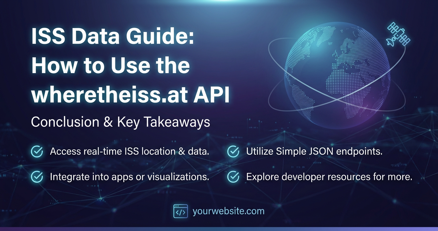
Conclusion: Charting New Courses with ISS Data
Our journey through the wheretheiss.at api has revealed a simple yet profound truth: the vast and awe-inspiring world of space exploration isn't just for astronauts and scientists; it's accessible to anyone with a curiosity and a connection to the internet. From its origins as a beacon of human collaboration in orbit to its real-time data streaming through accessible apis, the International Space Station continues to inspire, educate, and empower.
The wheretheiss.at api serves as an exemplary gateway to this inspiration. Its straightforward RESTful design, offering real-time coordinates, orbital parameters, and crew information, makes it an ideal starting point for beginners delving into api consumption. We've explored how to tap into this data using simple curl commands and Python scripts, breaking down the JSON responses field by field. More importantly, we've unleashed the creative potential of this data, envisioning and detailing applications ranging from interactive web maps and desktop notification systems to historical data analysis, educational tools, and even artistic installations. Each example underscores the versatility and power inherent in open data accessed through a well-designed api.
Furthermore, we've navigated the essential considerations for responsible and effective api usage, including rate limiting, robust error handling, understanding data limitations, and the broader security landscape relevant to other apis. As projects scale and integrate numerous apis—be they public, private, or AI-driven—the demand for sophisticated management solutions becomes paramount. This is where platforms like APIPark offer an invaluable layer of abstraction and control, streamlining the entire API lifecycle and allowing developers to focus on innovation rather than infrastructure.
Ultimately, using the wheretheiss.at api is more than just querying a server; it's an invitation to engage with one of humanity's greatest technological achievements. It’s an opportunity to build, to learn, and to connect with the ongoing narrative of space. Whether you're a seasoned developer, an aspiring data scientist, an educator, or simply a curious enthusiast, the tools and knowledge presented in this guide equip you to transform raw data into meaningful experiences. So, fire up your code editor, experiment with the endpoints, and start charting your own course through the incredible data streams from the International Space Station. The only limit is your imagination.
Frequently Asked Questions (FAQs)
1. What is wheretheiss.at and how does its API work? wheretheiss.at is a website and an associated API that provides real-time data about the International Space Station (ISS). Its API is a RESTful service that offers two primary endpoints: one for the ISS's current geographical location (latitude, longitude, altitude, velocity, etc.) and another for the list of astronauts currently on board. You make an HTTP GET request to these endpoints, and the API responds with data in JSON format, which is easy for applications to parse and use.
2. Is the wheretheiss.at API free to use and does it require authentication? Yes, the wheretheiss.at API is completely free to use for public, unauthenticated access. You do not need an API key, token, or any form of registration to retrieve data from its primary endpoints. This makes it an excellent resource for beginners learning about APIs and for quick integration into personal or educational projects.
3. How often should I query the wheretheiss.at API to get real-time data? While the API doesn't specify strict rate limits, it's best practice to query responsibly to avoid overloading their servers. For real-time tracking, fetching data every 3 to 5 seconds is generally sufficient and provides a smooth update experience without excessive requests. For data logging or less time-sensitive applications, polling every 30 seconds to a minute is perfectly adequate.
4. What kind of applications can I build using the wheretheiss.at API? The API's data can power a wide range of applications, including: * Real-time web or desktop maps showing the ISS's current position. * Desktop notification systems to alert you when the ISS passes over a specific location. * Data logging tools to collect historical ISS telemetry for analysis. * Educational displays or interactive exhibits for schools and museums. * Artistic installations that react to the ISS's movement or crew status. * Integration into larger systems that combine ISS data with other astronomical or environmental APIs.
5. Can the wheretheiss.at API predict future ISS passovers for my location? No, the wheretheiss.at API primarily provides the current location and status of the ISS. It does not offer functionality for predicting future passover times for a specific ground observer. For passover predictions, you would typically need to use other dedicated APIs (e.g., from N2YO.com) or employ specialized orbital mechanics libraries (like Skyfield or PyEphem in Python) that can calculate future positions based on Two-Line Element (TLE) data.
🚀You can securely and efficiently call the OpenAI API on APIPark in just two steps:
Step 1: Deploy the APIPark AI gateway in 5 minutes.
APIPark is developed based on Golang, offering strong product performance and low development and maintenance costs. You can deploy APIPark with a single command line.
curl -sSO https://download.apipark.com/install/quick-start.sh; bash quick-start.sh

In my experience, you can see the successful deployment interface within 5 to 10 minutes. Then, you can log in to APIPark using your account.

Step 2: Call the OpenAI API.