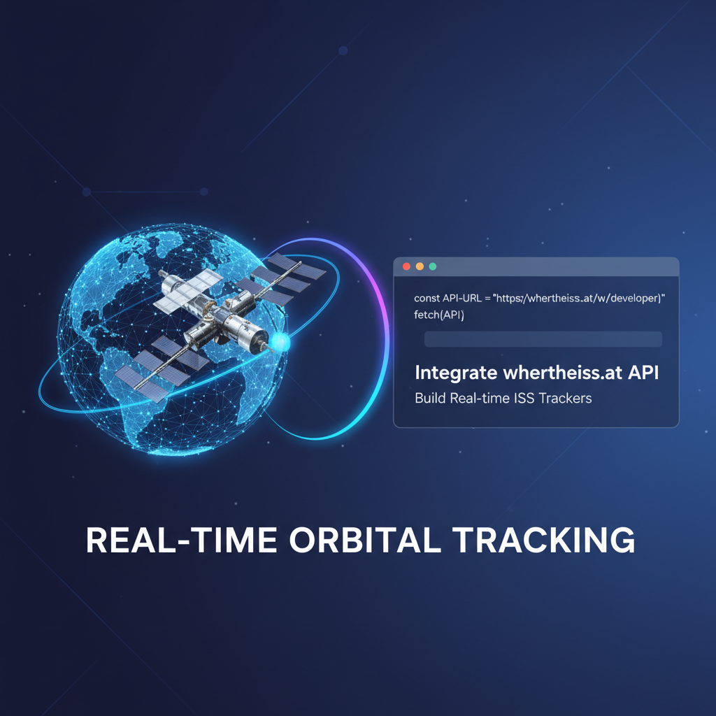
Integrate wheretheiss.at API: Build Real-time ISS Trackers


The International Space Station (ISS) is a beacon of human ingenuity, orbiting our planet at an astounding speed, a visible testament to collaborative scientific exploration. For countless enthusiasts, educators, and amateur astronomers, tracking its relentless journey across the night sky is a source of profound fascination. While observing it with the naked eye is a thrilling experience, imagine having the power to pinpoint its exact location at any given moment, or even predict its next visible pass over your home, all at your fingertips. This level of real-time interaction with such a complex celestial object is made possible not by advanced telescopes or specialized ground stations, but by the remarkable simplicity and power of Application Programming Interfaces, or APIs.
This comprehensive guide delves into the exciting world of building real-time ISS trackers using the wheretheiss.at API. We will embark on a detailed journey, starting from the fundamental concepts of APIs, moving through practical implementation steps, exploring advanced features, and ultimately discussing best practices for managing your API integrations. By the end of this article, you will possess the knowledge and tools to create your own sophisticated ISS tracking application, transforming raw orbital data into an engaging and informative experience. Whether you aspire to build a simple console application, an interactive web map, or even a notification system, the wheretheiss.at API provides the gateway to unlock this captivating universe of data.
The Celestial Ballet: Understanding the International Space Station
Before we dive into the technical intricacies of tracking, it’s essential to appreciate the object we are pursuing: the International Space Station. More than just a dot in the sky, the ISS is an unparalleled feat of engineering and international collaboration, serving as humanity's most advanced orbiting research laboratory. Launched in components from 1998 onwards, it has been continuously inhabited since November 2000, hosting astronauts and cosmonauts from multiple nations who conduct groundbreaking scientific experiments in microgravity.
The ISS orbits Earth at an average altitude of approximately 400 kilometers (250 miles). Its velocity is breathtakingly fast, hurtling through space at roughly 28,000 kilometers per hour (17,500 miles per hour). This incredible speed means it completes one full orbit of Earth approximately every 90 minutes. Consequently, within a single 24-hour period, the ISS circles our planet about 16 times, offering numerous opportunities for observation from various locations. Its sheer size – roughly the length of an American football field – makes it the largest artificial object in Earth orbit and, under optimal conditions, it is often visible to the naked eye as a bright, fast-moving point of light, appearing brighter than most stars and planets.
Tracking the ISS serves multiple purposes. For educational institutions and budding astronomers, it provides a tangible link to space exploration and orbital mechanics. For personal projects, it’s an engaging way to connect with a global scientific endeavor. Understanding its path is not merely an academic exercise; it offers practical applications, from planning stargazing sessions to simply appreciating the sheer scale of human achievement in space. The challenge, of course, lies in converting its complex, ever-changing orbital path into simple, actionable coordinates – a task perfectly suited for the capabilities of a well-designed api.
The Digital Connective Tissue: A Deep Dive into APIs
At the heart of modern software development lies the concept of an Application Programming Interface, or api. In its simplest form, an API acts as a messenger that takes requests from one application and delivers them to another, then takes the response from that application and delivers it back to the first. Think of it as a waiter in a restaurant: you (the client application) tell the waiter (the API) what you want to order (make a request), the waiter goes to the kitchen (the server application), gets your food (the data), and brings it back to you. You don't need to know how the kitchen prepares the food; you just need to know how to order it.
APIs are fundamental to how almost all digital services interact today. When you check the weather on your phone, stream a movie, or even log into an app using your social media account, APIs are working tirelessly behind the scenes. They enable different software systems, potentially built by different teams using different programming languages, to communicate and share data in a standardized way. This interoperability is what fuels the vast, interconnected ecosystem of modern applications, allowing developers to leverage existing services rather than having to reinvent every wheel.
Most APIs that facilitate communication between web services, like the wheretheiss.at API, adhere to principles of Representational State Transfer, commonly known as REST. A RESTful api utilizes standard HTTP methods (GET, POST, PUT, DELETE) to perform actions on resources. For our ISS tracker, we will primarily be using the GET method to retrieve data, as we are only requesting information about the ISS's current position, not modifying anything.
Data exchanged through web APIs is typically formatted in a lightweight, human-readable, and machine-parsable format. JSON (JavaScript Object Notation) has emerged as the de facto standard for this purpose due to its simplicity and ubiquity across programming languages. A JSON response consists of key-value pairs, nested objects, and arrays, making it incredibly flexible for structuring diverse types of data. Understanding how to parse JSON will be a critical skill in extracting the ISS's coordinates from the API's response. The widespread adoption of JSON, along with standardized HTTP protocols, makes integrating external services through their APIs a much more straightforward task than it once was, democratizing access to vast amounts of data and functionality.
Unlocking the ISS's Location: The wheretheiss.at API
The wheretheiss.at API is a beautifully simple and highly effective tool for accessing real-time data about the International Space Station's position. Unlike many commercial APIs, it requires no authentication, making it incredibly accessible for hobbyists, students, and developers building personal projects. This openness is a significant advantage, allowing you to jump straight into data retrieval without the overhead of API keys, tokens, or complex authorization flows.
The API offers several key endpoints, each designed to provide specific information about the ISS:
/iss-now.json: This is the primary endpoint for real-time tracking. It provides the current geographical coordinates (latitude and longitude) of the ISS, along with a Unix timestamp indicating when the data was recorded. This endpoint is ideal for applications that need to display the ISS's immediate location on a map./satellites/{satelliteid}/positions: Whilewheretheiss.atmainly focuses on the ISS, this general endpoint implies the capability to track other satellites given their ID. For the ISS, the ID is typically not explicitly needed when usingiss-now.json./iss-pass.json: This endpoint is crucial for predicting when the ISS will pass over a specific location on Earth. It requires latitude, longitude, and optionally altitude parameters for a given observer. The API then returns a list of upcoming pass events, including the duration of the pass and the rise and set times. This is invaluable for anyone wanting to visually observe the ISS.
Let's focus on the iss-now.json endpoint, as it forms the backbone of any real-time tracker. When you make a GET request to http://api.wheretheiss.at/v1/satellites/iss-now.json, the API responds with a JSON object similar to this:
{
  "iss_position": {
    "latitude": "49.1234",
    "longitude": "-123.5678"
  },
  "timestamp": 1678886400,
  "message": "success"
}
Here, iss_position is an object containing latitude and longitude as strings. The timestamp is a Unix epoch time, representing the number of seconds that have elapsed since January 1, 1970 (UTC). The message field simply confirms the success of the API call.
Understanding this structure is paramount. Your application will need to: 1. Initiate an HTTP GET request to the specified URL. 2. Receive the JSON response from the server. 3. Parse the JSON string into a usable data structure within your chosen programming language. 4. Extract the latitude, longitude, and timestamp values. 5. Convert the timestamp into a human-readable date and time.
The wheretheiss.at API is designed for robustness and high availability, meaning you can generally expect consistent and reliable data. While there isn't an explicit rate limit mentioned for this public API, it's always good practice to implement a reasonable polling interval (e.g., once every 1-5 seconds) to avoid overwhelming the server, especially if your application scales. This thoughtful approach ensures good API citizenship and sustained access to this valuable resource.
Setting Up Your Digital Workbench: The Development Environment
Before writing any code, preparing your development environment is a crucial first step. A well-configured setup streamlines the coding process, reduces frustrating roadblocks, and allows you to focus purely on the logic of your application. The beauty of API integration is its language agnosticism; you can build an ISS tracker using virtually any modern programming language. For the sake of practicality and widespread accessibility, we will primarily use Python for our code examples, but the core concepts are transferable.
Choosing Your Programming Language
- Python: Excellent for beginners due to its clear syntax and extensive libraries. The
requestslibrary makes HTTP requests incredibly simple, and its data manipulation capabilities are robust. Ideal for console applications, backend services, and even desktop GUIs with libraries like Tkinter or PyQt. - JavaScript (Node.js for backend, browser for frontend): The language of the web. Node.js is perfect for building server-side applications that fetch data, while browser-side JavaScript, combined with HTML and CSS, is essential for interactive web-based map visualizations. The
fetchAPI oraxioslibrary are common choices for HTTP requests. - Ruby: Known for its developer-friendly syntax and the powerful Ruby on Rails framework. Libraries like
Net::HTTPorHTTPartysimplify API interactions. - Go (Golang): Gaining popularity for its performance and concurrency features, Go is a strong choice for high-performance backend services. Its built-in
net/httppackage is quite capable. - C# (.NET): A robust choice for Windows desktop applications, enterprise solutions, and increasingly for cross-platform development with .NET Core.
HttpClientis the standard for HTTP requests.
Regardless of your choice, the fundamental steps of making an HTTP request, parsing JSON, and handling data remain consistent.
Essential Tools
- Integrated Development Environment (IDE) or Text Editor:
- VS Code: A highly popular, free, and open-source editor with excellent support for virtually all programming languages, thanks to its vast extension ecosystem. It offers features like syntax highlighting, intelligent code completion (IntelliSense), and integrated debugging.
- PyCharm (for Python): A dedicated Python IDE offering advanced features for professional Python development, including project management, code analysis, and testing tools.
- Sublime Text, Atom: Lightweight and highly customizable text editors.
- Terminal or Command Prompt: You'll need this to run your scripts, install packages, and interact with your operating system.
- Package Manager:
pip(Python): The standard package installer for Python. Used to install third-party libraries likerequests.npmoryarn(JavaScript/Node.js): Package managers for Node.js, used to install libraries likeaxiosorexpress.bundler(Ruby): A dependency manager for Ruby projects.
- Internet Connection: Obviously essential for accessing the
wheretheiss.atAPI.
Initial Python Setup Example
Let's quickly set up a basic Python environment:
- Install Python: If you don't have Python installed, download it from python.org. Ensure you check the "Add Python to PATH" option during installation on Windows.
- Create a Project Directory:
bash mkdir iss_tracker cd iss_tracker - Create a Virtual Environment (Recommended): Virtual environments isolate your project's dependencies, preventing conflicts with other Python projects or your system-wide Python installation.
bash python -m venv venv - Activate the Virtual Environment:
- Windows:
.\venv\Scripts\activate - macOS/Linux:
source venv/bin/activateYou'll see(venv)prepended to your terminal prompt, indicating the environment is active.
- Windows:
- Install the
requestslibrary:bash pip install requests
With these steps, your environment is ready, and you can begin writing your first lines of code to fetch data from the wheretheiss.at API. This methodical approach to environment setup lays a solid foundation for more complex and robust applications, ensuring consistency and preventing "it works on my machine" scenarios.
Building Your First ISS Tracker: A Python Implementation
Now that our development environment is prepared, let's dive into the core task: making an API request to wheretheiss.at and extracting the ISS's real-time position. We'll start with a simple Python script that fetches the data and prints it to the console.
Step 1: Making the API Request
The Python requests library is renowned for its simplicity and elegance in handling HTTP requests. It abstracts away much of the complexity of underlying network communication, allowing you to focus on the data.
Create a file named iss_tracker.py in your project directory and add the following code:
import requests
import json
import datetime
import time

# Define the API endpoint for the ISS's current position
ISS_API_URL = "http://api.wheretheiss.at/v1/satellites/iss-now.json"

def get_iss_position():
    """
    Fetches the current position of the ISS from the wheretheiss.at API.
    Handles network errors and API response parsing.
    """
    try:
        response = requests.get(ISS_API_URL)
        response.raise_for_status() # Raise an exception for HTTP errors (4xx or 5xx)

        data = response.json() # Parse the JSON response

        # Extract relevant information
        latitude = float(data['iss_position']['latitude'])
        longitude = float(data['iss_position']['longitude'])
        timestamp = data['timestamp']

        # Convert Unix timestamp to a human-readable datetime object
        dt_object = datetime.datetime.fromtimestamp(timestamp, tz=datetime.timezone.utc)

        print(f"[{dt_object.strftime('%Y-%m-%d %H:%M:%S UTC')}] ISS Position:")
        print(f"  Latitude: {latitude:.4f}")
        print(f"  Longitude: {longitude:.4f}")
        print("-" * 30)

        return latitude, longitude, dt_object

    except requests.exceptions.HTTPError as http_err:
        print(f"HTTP error occurred: {http_err}")
    except requests.exceptions.ConnectionError as conn_err:
        print(f"Connection error occurred: {conn_err}")
    except requests.exceptions.Timeout as timeout_err:
        print(f"Timeout error occurred: {timeout_err}")
    except requests.exceptions.RequestException as req_err:
        print(f"An unexpected request error occurred: {req_err}")
    except json.JSONDecodeError as json_err:
        print(f"Error decoding JSON response: {json_err}")
        print(f"Response content: {response.text if 'response' in locals() else 'No response received'}")
    except KeyError as key_err:
        print(f"Missing expected key in JSON response: {key_err}")
    except Exception as e:
        print(f"An unexpected error occurred: {e}")

    return None, None, None # Return None on error

if __name__ == "__main__":
    print("Starting ISS Real-time Tracker...")
    # Fetch once for demonstration
    get_iss_position()
    print("Tracker finished.")
Code Breakdown and Elaboration:
import requests, json, datetime, time: These lines import the necessary libraries.requestsfor making HTTP requests,jsonfor parsing JSON (thoughrequests.json()usually handles this),datetimefor timestamp conversions, andtimefor potential delays.ISS_API_URL: A constant storing the endpoint URL. Using constants makes your code cleaner and easier to modify.get_iss_position()function: Encapsulating the logic within a function promotes modularity and reusability.requests.get(ISS_API_URL): This is the core of the API call. It sends an HTTP GET request to the specified URL. Therequestslibrary automatically handles many underlying details like establishing connections and managing headers.response.raise_for_status(): This is a crucial error handling step. If the HTTP request returns an unsuccessful status code (e.g., 404 Not Found, 500 Internal Server Error), this method will raise anHTTPError. This is much cleaner than manually checkingresponse.status_codeafter every request.data = response.json(): Assuming the request was successful and the response body is valid JSON, this method conveniently parses the JSON string into a Python dictionary. This is where the magic of JSON parsing happens, converting a raw string into a structured, accessible object.- Extracting Data (
latitude,longitude,timestamp): We access the values using dictionary keys (e.g.,data['iss_position']['latitude']). Notice that thelatitudeandlongitudeare initially strings in the JSON response, so we convert them tofloatfor numerical operations and better precision in display (.4fformatting). datetime.datetime.fromtimestamp(timestamp, tz=datetime.timezone.utc): The timestamp from the API is a Unix epoch time. This line converts it into a more human-readabledatetimeobject. We specifytz=datetime.timezone.utcto ensure the time is interpreted as Coordinated Universal Time, consistent with the API's output.dt_object.strftime('%Y-%m-%d %H:%M:%S UTC'): Formats thedatetimeobject into a standardized string for clear display.- Error Handling (
try-exceptblocks): This is vital for robust applications.requests.exceptions.HTTPError: Catches issues where the API server responds with an error status (e.g., 404, 500).requests.exceptions.ConnectionError: Handles cases where the network connection itself fails (e.g., no internet, DNS issues).requests.exceptions.Timeout: Catches requests that take too long to receive a response.requests.exceptions.RequestException: A general catch-all for any otherrequestsrelated error.json.JSONDecodeError: Catches errors if the API returns something that isn't valid JSON.KeyError: Catches errors if the JSON response is missing an expected key (e.g.,iss_positionorlatitude). This indicates a change in the API's response structure or an invalid response.Exception as e: A general fallback for any other unexpected issues, providing a safety net.- In case of an error, the function prints an informative message and returns
Nonefor the coordinates and timestamp, indicating failure.
Running the Script:
- Save the
iss_tracker.pyfile. - Open your terminal or command prompt.
- Navigate to your
iss_trackerdirectory. - Activate your virtual environment (if you created one).
- Run the script:
python iss_tracker.py
You should see output similar to this (timestamps and coordinates will vary):
Starting ISS Real-time Tracker...
[2023-10-27 10:30:45 UTC] ISS Position:
  Latitude: 49.1234
  Longitude: -123.5678
------------------------------
Tracker finished.
This basic script successfully retrieves and displays the ISS's current location. It forms the bedrock upon which we can build more sophisticated real-time tracking applications, complete with continuous updates and compelling visualizations. The thorough error handling ensures that our application is resilient to common issues, making it more user-friendly and reliable in real-world scenarios.
Bringing the ISS to Life: Real-time Updates and Visualization
A static display of the ISS's position, while informative, doesn't capture the dynamism of its orbit. The true power of a real-time tracker lies in its ability to continuously update, showing the ISS moving across the globe. Furthermore, visualizing this movement on a map transforms abstract coordinates into a compelling and intuitive experience.
Implementing Real-time Updates (Polling)
The simplest way to achieve real-time updates for a web API that doesn't push data (like wheretheiss.at) is through a technique called polling. This involves repeatedly making API requests at regular intervals.
Let's modify our iss_tracker.py to continuously fetch and display the ISS's position every few seconds:
# ... (imports and get_iss_position function remain the same) ...

if __name__ == "__main__":
    print("Starting ISS Real-time Tracker...")
    update_interval_seconds = 5 # Update every 5 seconds

    try:
        while True: # Loop indefinitely
            latitude, longitude, dt_object = get_iss_position()

            if latitude is not None and longitude is not None:
                # Here you would typically send this data to a visualization layer
                # For now, we just print it as before.
                pass # The get_iss_position already prints it.

            time.sleep(update_interval_seconds) # Pause for the specified interval

    except KeyboardInterrupt:
        print("\nISS Tracker stopped by user.")
    except Exception as e:
        print(f"An error occurred in the main loop: {e}")
    print("Tracker finished.")
Now, when you run the script, it will continuously fetch and print the ISS's position every 5 seconds until you manually stop it (e.g., by pressing Ctrl+C in the terminal).
Considerations for Polling: * Update Interval: Choosing the right interval is a balance. Too frequent, and you might hit API rate limits or consume excessive resources. Too infrequent, and your "real-time" tracker becomes less accurate. For wheretheiss.at, 3-5 seconds is a good starting point, as the ISS moves roughly 7-10 kilometers in that time. * API Rate Limits: Always be mindful of the API's terms of service. While wheretheiss.at is very generous, other APIs might impose strict limits (e.g., 60 requests per minute). Ignoring these can lead to your IP being blocked. * Resource Usage: Constant requests consume network bandwidth and CPU cycles. For client-side applications (like web browsers), this can affect user experience.
Web-based Visualization with Mapping Libraries
Displaying the ISS on a map brings the tracker to life. For web applications, JavaScript mapping libraries are the go-to solution. Popular choices include Leaflet.js, Google Maps API, and Mapbox GL JS. We'll use Leaflet.js for its open-source nature, simplicity, and ease of integration.
Here's how you can create a simple web-based ISS tracker using HTML, CSS, and JavaScript with Leaflet:
Create tracker.js: ```javascript // Initialize the map const map = L.map('mapid').setView([0, 0], 2); // Centered at [0,0] with zoom level 2// Add a tile layer (OpenStreetMap) L.tileLayer('https://{s}.tile.openstreetmap.org/{z}/{x}/{y}.png', { attribution: '© OpenStreetMap contributors' }).addTo(map);// Create a custom icon for the ISS const issIcon = L.icon({ iconUrl: 'https://upload.wikimedia.org/wikipedia/commons/d/d0/International_Space_Station_%28ISS%29_transparent.png', iconSize: [50, 32], // size of the icon iconAnchor: [25, 16], // point of the icon which will correspond to marker's location popupAnchor: [0, -16] // point from which the popup should open relative to the iconAnchor });// Create a marker for the ISS const issMarker = L.marker([0, 0], { icon: issIcon }).addTo(map);// Get info elements const timestampSpan = document.getElementById('timestamp'); const latitudeSpan = document.getElementById('latitude'); const longitudeSpan = document.getElementById('longitude');// API endpoint const ISS_API_URL = "http://api.wheretheiss.at/v1/satellites/iss-now.json";// Function to fetch and update ISS position async function updateISS() { try { const response = await fetch(ISS_API_URL); if (!response.ok) { throw new Error(HTTP error! status: ${response.status}); } const data = await response.json();
    const { latitude, longitude } = data.iss_position;
    const timestamp = data.timestamp;

    // Update marker position
    issMarker.setLatLng([latitude, longitude]);
    map.panTo([latitude, longitude], { animate: true, duration: 1.0 }); // Smoothly pan to new position

    // Update info display
    const dt_object = new Date(timestamp * 1000); // Convert Unix timestamp to milliseconds
    timestampSpan.textContent = dt_object.toUTCString();
    latitudeSpan.textContent = parseFloat(latitude).toFixed(4);
    longitudeSpan.textContent = parseFloat(longitude).toFixed(4);

} catch (error) {
    console.error("Error fetching ISS position:", error);
    timestampSpan.textContent = "Error!";
    latitudeSpan.textContent = "Error!";
    longitudeSpan.textContent = "Error!";
}
}// Initial update and then set interval for continuous updates updateISS(); setInterval(updateISS, 5000); // Update every 5 seconds ```
Create index.html: ```html <!DOCTYPE html>Real-time ISS Tracker
🛰️ Real-time ISS Tracker
Last Updated: Loading...
Latitude: Loading..., Longitude: Loading...
<!-- Leaflet JavaScript -->
<script src="https://unpkg.com/leaflet@1.9.4/dist/leaflet.js"
        integrity="sha256-20n9hL4M9X1yR02V+1+B6p4r/P4uPzWb1g+A/t+D+Q=="
        crossorigin=""></script>
<!-- Custom JavaScript for the tracker -->
<script src="tracker.js"></script>
```
To run this web tracker, simply open the index.html file in your web browser. You'll see a map with an ISS icon that moves every 5 seconds, updating its position.
Code Breakdown (Web Visualization):
index.html:- Links to Leaflet's CSS and JavaScript files from a CDN (Content Delivery Network).
- Defines a
divwithid="mapid"where the map will be rendered. - Includes basic HTML elements (
h1,divwithid="info") to display coordinates and timestamp. - Links to our custom
tracker.jsscript.
tracker.js:L.map('mapid').setView([0, 0], 2): Initializes a Leaflet map, linking it to themapiddiv.[0, 0]centers the map at the equator and prime meridian, and2is the initial zoom level.L.tileLayer(...): Adds a base map layer. Here, we're using OpenStreetMap tiles, which are free to use. Theattributionis important for legal compliance.L.icon(...): Creates a custom icon for the ISS marker using an image URL. This makes the marker visually distinctive.L.marker([0, 0], { icon: issIcon }).addTo(map): Creates an initial marker at[0,0]with our custom icon and adds it to the map.updateISS()function:- Uses the modern
fetchapi for making asynchronous HTTP requests in JavaScript.awaitensures the code waits for the response before proceeding. - Checks
response.okfor HTTP errors, similar toraise_for_status()in Python. - Parses the JSON response using
response.json(). issMarker.setLatLng([latitude, longitude]): The core of the update. This method changes the position of the existing marker on the map.map.panTo([latitude, longitude], { animate: true, duration: 1.0 }): Smoothly moves the map's center to follow the ISS.- Updates the
timestamp,latitude, andlongitudedisplayed in theinfodiv.
- Uses the modern
setInterval(updateISS, 5000): Calls theupdateISSfunction every 5000 milliseconds (5 seconds), creating the real-time effect.
This web-based tracker provides a much more engaging experience, visually demonstrating the ISS's continuous movement across the Earth's surface. It's a powerful example of how combining a simple API with modern web technologies can create compelling and informative applications.
Desktop Applications
For those preferring a native desktop experience, frameworks like Python's Tkinter (built-in), PyQt, Kivy, or Electron (using web technologies for cross-platform desktop apps) can be used. The core logic of fetching and parsing data remains identical to the Python console example. The main difference lies in building the graphical user interface (GUI) and integrating a map widget (which might involve embedding a web view or using specialized geospatial libraries for desktop).
For example, a Tkinter application could: 1. Fetch ISS data using requests. 2. Display coordinates and timestamp in Label widgets. 3. Optionally, embed an interactive map using libraries that can render web content (like cefpython or a simple image based on static map services if full interactivity isn't needed).
The choice between console, web, or desktop depends heavily on your project goals, target audience, and personal development preferences. Each approach leverages the wheretheiss.at api in its own way to bring the ISS's journey to life.
APIPark is a high-performance AI gateway that allows you to securely access the most comprehensive LLM APIs globally on the APIPark platform, including OpenAI, Anthropic, Mistral, Llama2, Google Gemini, and more.Try APIPark now! 👇👇👇
Advanced Concepts and Further Development
Building a basic real-time ISS tracker is a fantastic starting point, but the wheretheiss.at API, combined with other data sources and advanced programming techniques, offers a wealth of opportunities for creating truly sophisticated applications. Let's explore some of these advanced concepts.
1. Predicting Future Passes (/iss-pass.json)
While real-time tracking shows where the ISS is, predicting future passes tells you where it will be relative to a specific observation point. This is invaluable for amateur astronomers or anyone wanting to step outside and visually spot the ISS. The wheretheiss.at API provides a dedicated endpoint for this: /iss-pass.json.
This endpoint requires specific parameters: * lat: The observer's latitude. * lon: The observer's longitude. * alt (optional): The observer's altitude in meters (default is 0). * n (optional): The number of future passes to retrieve (default is 5).
Example API call: http://api.wheretheiss.at/v1/satellites/25544/passes?lat=40.7128&lon=-74.0060&n=5 (Note: 25544 is the ISS satellite ID, though iss also works in some contexts).
The response contains a list of pass predictions, each with risetime (Unix timestamp for when the ISS becomes visible), duration (in seconds for how long it's visible), and other related information.
Implementation Challenge: Integrate this into your web tracker by allowing users to input their location. Fetch pass predictions and display them in a list, perhaps with a countdown to the next visible pass. You could even integrate with a weather API to check for clear skies during the predicted pass times, offering a truly enhanced observation experience.
2. Data Storage and History
A real-time tracker provides a snapshot, but what if you want to see the ISS's path over the last 24 hours, or even its trajectory over several months? Storing historical data allows for: * Visualizing past trajectories: Drawing lines on a map to show where the ISS has been. * Data analysis: Identifying patterns, such as which countries or regions the ISS frequently passes over. * Offline access: Providing some data even if the API is temporarily unavailable.
Implementation Strategy: Choose a database: * SQLite: Excellent for simple, file-based storage in desktop applications or small web services. No separate server required. * PostgreSQL/MySQL: More robust relational databases suitable for larger web applications. * MongoDB: A NoSQL document database, flexible for storing semi-structured data like ISS positions.
Your application would periodically (e.g., every 10-30 seconds, less frequently than display updates) save the latitude, longitude, and timestamp to your chosen database. Then, a separate function could query this historical data for visualization or analysis.
3. Alerts and Notifications
Imagine receiving a notification when the ISS is about to pass over your location, or when it enters a specific geographic zone. This adds a proactive dimension to your tracker.
Notification Channels: * Email: Use services like SendGrid, Mailgun, or your own SMTP server. * SMS: Integrate with Twilio or similar SMS gateway APIs. * Push Notifications: For web apps (using browser APIs) or mobile apps (using Firebase Cloud Messaging, Apple Push Notification service). * Desktop Pop-ups: Native notifications for desktop applications.
Logic: Combine the iss-pass.json endpoint with a persistent background process. When a risetime approaches, trigger a notification. For geographical zone alerts, your real-time tracker would continuously compare the ISS's current latitude and longitude with predefined boundary coordinates.
4. Geospatial Analysis and Context
Adding geospatial context makes the ISS's position more meaningful. * Reverse Geocoding: Convert the latitude and longitude into a human-readable location (e.g., "Over the Pacific Ocean," "Near Tokyo, Japan"). This can be achieved using services like OpenStreetMap Nominatim API, Google Geocoding API, or Mapbox Geocoding API. * Country/Region Overlay: Determine which country or continent the ISS is currently flying over. This requires querying geographical shapefiles or another API that provides country boundary data for a given coordinate. * Distance Calculation: Calculate the straight-line distance from your current location to the ISS's current position (though it's orbiting at altitude, a surface distance is a good approximation for context).
These additions enrich the user experience by providing immediate, understandable context to the raw coordinates.
5. Integration with Other APIs
The true power of APIs often lies in their ability to be combined, creating composite applications that offer more than the sum of their parts. * Weather APIs: As mentioned, check local weather conditions for clear skies before an ISS pass. * Astronomy APIs: Display information about other celestial bodies, upcoming meteor showers, or moon phases alongside the ISS data. * NASA APIs: NASA provides a wealth of public APIs. You could fetch information about current ISS crew members, recent mission events, or even historical images of Earth taken from the ISS, creating a more comprehensive space-themed application.
By integrating other services, your ISS tracker evolves into a broader space exploration hub, demonstrating the immense possibilities when different data sources are connected through well-defined APIs. Each of these advanced features not only adds functionality but also deepens the technical challenge and learning opportunity, pushing the boundaries of what a simple tracker can achieve.
API Management and Best Practices
As your application grows in complexity, potentially integrating multiple APIs and serving a larger user base, the importance of robust API management and adherence to best practices becomes paramount. This ensures your application is reliable, scalable, and a responsible consumer of external services.
Rate Limiting and Backoff Strategies
Many APIs, even public ones like wheretheiss.at, have implied or explicit rate limits to prevent abuse and ensure fair usage for all. Exceeding these limits can lead to temporary or permanent IP bans.
Best Practices: * Understand Limits: Always check the API documentation for any stated rate limits. * Client-Side Throttling: Implement delays (e.g., time.sleep() in Python, setInterval() in JavaScript) to ensure your application doesn't make requests faster than permitted. * Exponential Backoff: If you encounter a 429 Too Many Requests error, don't immediately retry. Instead, wait for an increasing amount of time before each retry attempt (e.g., 1 second, then 2, then 4, up to a maximum). This gives the server time to recover and avoids exacerbating the problem. * Jitter: When using exponential backoff, add a small random delay (jitter) to your wait times. This prevents multiple clients from retrying simultaneously after a rate limit, creating another surge.
Robust Error Handling
As demonstrated in our Python example, comprehensive error handling is crucial. Network issues, API downtime, unexpected response formats, or changes in API behavior can all disrupt your application.
Key Strategies: * Specific Exception Handling: Catch specific exceptions (e.g., requests.exceptions.ConnectionError, json.JSONDecodeError) to provide tailored error messages and recovery strategies. * Graceful Degradation: If an API call fails, your application shouldn't crash. Instead, display a user-friendly message, use cached data if available, or simply pause updates until the issue resolves. * Logging: Record detailed error messages, timestamps, and request parameters. This is invaluable for debugging and understanding recurring issues.
Security Considerations
While the wheretheiss.at API doesn't require authentication, most APIs for sensitive data do. Understanding general API security principles is vital for any developer.
- API Keys: If an API uses keys, keep them secure. Never embed them directly in client-side JavaScript or public repositories. Use environment variables or secure configuration files for server-side applications.
- OAuth 2.0 / JWT: For more complex authentication, understand protocols like OAuth 2.0, which allow users to grant your application limited access to their data without sharing their credentials. JSON Web Tokens (JWTs) are commonly used to securely transmit information between parties.
- Input Validation: Sanitize and validate any user input before sending it to an API to prevent injection attacks or malformed requests.
- HTTPS: Always use HTTPS for API communication to encrypt data in transit, protecting against eavesdropping and tampering.
Scalability and Performance
If your ISS tracker becomes popular, you'll need to consider how it handles increased load. * Caching: Store frequently requested API responses locally (e.g., in memory, a local database, or a dedicated caching service like Redis). This reduces the number of calls to the external API and speeds up response times for your users. For the ISS's position, you could cache it for a few seconds. * Asynchronous Processing: For long-running tasks (like fetching multiple API responses concurrently), use asynchronous programming (e.g., asyncio in Python, async/await in JavaScript) to prevent your application from blocking. * Load Balancing: If running multiple instances of your application, use a load balancer to distribute incoming requests evenly, preventing any single instance from becoming overwhelmed.
Documentation and OpenAPI Specification
Clear and comprehensive API documentation is a developer's best friend. It describes how to interact with an API, its endpoints, parameters, response formats, and error codes. This is where the term OpenAPI specification shines.
OpenAPI (formerly known as Swagger) is a standardized, language-agnostic interface description for RESTful APIs. It allows both humans and computers to discover and understand the capabilities of a service without access to source code, documentation, or network traffic inspection.
Benefits of OpenAPI: * Better Developer Experience: Developers can quickly understand how to integrate an API, reducing onboarding time. * Automated Tooling: OpenAPI definitions can be used to automatically generate client SDKs, server stubs, and interactive documentation portals. * Consistency: Encourages consistent API design patterns across different services. * Validation: Can be used to validate API requests and responses against the defined schema.
Even for simpler APIs like wheretheiss.at, imagining an OpenAPI specification for it helps in understanding the structure and expected behavior more thoroughly. For projects that might evolve into their own API services (e.g., if you create a backend that aggregates ISS data with weather and astronaut info), using OpenAPI from the start is an excellent practice for future-proofing and collaboration.
Streamlining Your API Integrations: Introducing APIPark
As your development journey progresses from a single API integration to potentially managing multiple services – perhaps you're augmenting your ISS tracker with weather data, astronaut information, or even incorporating AI models for advanced analysis (e.g., predicting visibility based on cloud cover, or natural language processing for voice commands) – the complexity of API management can quickly escalate. Handling authentication for different services, standardizing data formats, monitoring performance, and ensuring security for each integrated API manually becomes a significant overhead.
This is precisely where platforms like APIPark become invaluable. APIPark is an open-source AI gateway and API management platform, designed to simplify the lifecycle of both traditional RESTful APIs and modern AI services. It acts as a centralized hub, sitting between your applications and the various external APIs or internal microservices you consume.
For a project like our ISS tracker, if it were to grow into a more ambitious platform involving numerous data streams and perhaps even proprietary AI models for predictive analysis, APIPark's features would be incredibly beneficial:
- Unified API Format & Management: Imagine integrating not just
wheretheiss.at, but also a weather API, a NASA astronaut API, and a custom AI model for "space event prediction." APIPark allows you to manage all these integrations from a single control plane, even standardizing their invocation format. This means your application doesn't have to adapt to each external API's unique quirks; APIPark handles the translation. - End-to-End API Lifecycle Management: From designing and publishing your own composite APIs (e.g., an
/iss-composite-infoAPI that combines ISS position, weather, and astronaut data) to managing their versioning, traffic forwarding, and eventual decommissioning, APIPark provides comprehensive tools. This ensures a regulated and efficient development process. - Performance and Scalability: As your tracker gains popularity, APIPark's high-performance gateway can handle large-scale traffic, rivaling dedicated web servers like Nginx. Its ability to support cluster deployment means your ISS tracker's backend (if you build one) can scale horizontally to meet demand without becoming a bottleneck.
- Detailed Monitoring and Analytics: APIPark provides extensive logging capabilities, recording every detail of each API call. This is critical for troubleshooting issues, understanding usage patterns, and ensuring the stability and security of your integrated services. Its powerful data analysis features can show long-term trends, helping you pre-emptively address performance degradation before it impacts users.
While wheretheiss.at is a simple public API, thinking about how APIPark could manage such an integration highlights the benefits of robust API management. If your simple tracker evolves into a complex system, requiring API keys for premium data, rate limit enforcement, or seamless integration of cutting-edge AI features, APIPark offers the architectural foundation to build, manage, and scale these capabilities efficiently and securely. It transforms the complexity of multi-API environments into a manageable, high-performance ecosystem.
Common Challenges and Troubleshooting
Developing with external APIs inherently comes with its own set of challenges. Knowing common pitfalls and how to troubleshoot them effectively can save hours of frustration.
1. Network Issues
- Symptom:
requests.exceptions.ConnectionError,requests.exceptions.Timeout, orfetchAPI showing network errors. - Troubleshooting:
- Check Internet Connection: The most basic step. Can you access
http://api.wheretheiss.atdirectly in your browser? - DNS Resolution: Ensure your system can resolve the API's domain name. Try
ping api.wheretheiss.atornslookup api.wheretheiss.at. - Firewall/Proxy: Your corporate firewall, antivirus, or a proxy server might be blocking outgoing requests. Test from a different network or temporarily disable these.
- API Server Status: Check if the
wheretheiss.atservice itself is down. While there's no dedicated status page, you can often find information on social media or developer forums if a major API is experiencing issues.
- Check Internet Connection: The most basic step. Can you access
2. API Downtime or Service Degradation
- Symptom:
requests.exceptions.HTTPErrorwith 5xx status codes (500 Internal Server Error, 503 Service Unavailable). - Troubleshooting:
- API Status Page: For critical APIs, always bookmark their status pages.
- Retry Logic: Implement exponential backoff for 5xx errors. The server might just be temporarily overloaded.
- Monitor Logs: Keep an eye on your application logs for recurring 5xx errors, which might indicate persistent API issues.
3. Incorrect Response or Parsing Errors
- Symptom:
json.JSONDecodeError,KeyError(Python), orTypeError(JavaScript) when trying to access data. - Troubleshooting:
- Print Raw Response: Temporarily print
response.text(Python) orresponse.json()before parsing (JavaScript) to inspect the exact data received. - Check API Documentation: Verify that the JSON structure you expect matches the API's current output. APIs can change, and fields might be renamed or removed.
- Data Types: Ensure you're handling data types correctly (e.g., converting strings to floats/integers when necessary). The
wheretheiss.atAPI returns latitude and longitude as strings. - Empty/Unexpected Responses: Sometimes, an API might return an empty array or a non-standard error message in JSON. Your parsing logic should account for these possibilities.
- Print Raw Response: Temporarily print
4. Geospatial Coordinate System Mismatches
- Symptom: The ISS marker appears in the wrong location on your map, or coordinates seem inverted.
- Troubleshooting:
- Latitude/Longitude Order: Map libraries typically expect
[latitude, longitude]. Ensure you're not accidentally passing[longitude, latitude]. This is a very common mistake. - Coordinate Range: Latitude ranges from -90 to +90, longitude from -180 to +180. Verify your extracted values are within these ranges.
- Projection: Most web maps use the WGS84 (World Geodetic System 1984) coordinate system. The
wheretheiss.atAPI provides coordinates in WGS84, so this is rarely an issue but good to be aware of if integrating with specialized GIS software.
- Latitude/Longitude Order: Map libraries typically expect
5. Time Zone and Timestamp Issues
- Symptom: Timestamps displayed are incorrect or off by several hours.
- Troubleshooting:
- Unix Epoch: The
wheretheiss.atAPI uses Unix epoch time (seconds since January 1, 1970 UTC). Ensure your conversion function correctly interprets this as UTC. - Local vs. UTC: When converting to human-readable format, decide whether to display in UTC (like the API provides) or convert to the user's local time zone. Explicitly handling time zones (
tz=datetime.timezone.utcin Python,toUTCString()ortoLocaleDateString()withtimeZoneoption in JavaScript) prevents ambiguities. - Millisecond vs. Second: Some APIs use Unix epoch in milliseconds.
wheretheiss.atuses seconds. A common error is multiplying by 1000 unnecessarily or failing to do so when required.
- Unix Epoch: The
By approaching troubleshooting methodically, inspecting raw data, and understanding the common pitfalls of API integration, you can quickly diagnose and resolve most issues, ensuring your ISS tracker remains reliable and accurate.
Ethical Considerations and Responsible API Usage
Developing applications that consume external APIs comes with responsibilities. Adhering to ethical guidelines and practicing responsible API usage ensures a healthy ecosystem for all developers and maintains the longevity of the services you rely on.
1. Respecting API Terms of Service (ToS)
Every API comes with a set of terms of service. While wheretheiss.at is very permissive, many commercial APIs have strict rules regarding: * Rate Limits: As discussed, adhere to these strictly. Implement retry logic with exponential backoff rather than hammering the server. * Data Usage: How can you use the data? Can it be stored, redistributed, or used for commercial purposes? * Attribution: Does the API require you to attribute the data source? For wheretheiss.at, it's good practice to acknowledge them. * Prohibited Uses: Are there any actions that are explicitly forbidden (e.g., reverse engineering, using the API for illegal activities)?
Ignoring the ToS can lead to your access being revoked, legal issues, or reputational damage.
2. Data Privacy and Security
While the wheretheiss.at API provides public, non-personal data, many APIs deal with sensitive user information. * Minimize Data Collection: Only collect the data you absolutely need. * Secure Data Storage: If you store any data (even non-personal data like historical ISS positions), ensure it's stored securely and is protected against unauthorized access. * GDPR, CCPA, etc.: If your application processes any personal data and operates in regions with data privacy regulations (like GDPR in Europe or CCPA in California), ensure full compliance. This includes aspects like user consent, data anonymization, and the right to be forgotten. * API Key Management: Treat API keys like passwords. Never hardcode them in publicly accessible code (e.g., frontend JavaScript or open-source repositories). Use environment variables or secure configuration management.
3. Resource Conservation and Efficiency
Every API request consumes server resources, network bandwidth, and electricity. * Efficient Polling: Don't poll an API more frequently than necessary. For the ISS, checking every 1-5 seconds is reasonable; checking every 100 milliseconds is likely excessive and wasteful. * Caching: Implement caching for data that doesn't change frequently or where slightly stale data is acceptable. This significantly reduces the load on the upstream API. * Conditional Requests: Some APIs support conditional requests using HTTP headers like If-None-Match (ETag) or If-Modified-Since. This allows the server to respond with 304 Not Modified if the data hasn't changed, saving bandwidth.
4. Transparency and User Trust
- Inform Users: Be transparent with your users about what data your application uses and why. If you're using external APIs, mention them.
- Clear Error Messages: Provide helpful and actionable error messages to users rather than cryptic technical jargon. If an API is down, tell them.
- Responsiveness: Design your application to be responsive and handle failures gracefully. A crashing application erodes user trust.
By embracing these ethical and responsible development practices, you not only build better, more reliable applications but also contribute positively to the wider developer community and ensure the continued availability of valuable public resources like the wheretheiss.at API. This mindful approach fosters sustainability and innovation in the world of connected services.
Conclusion
The journey from a blank canvas to a fully functional, real-time ISS tracker is a testament to the power and accessibility of modern api technology. We've traversed the landscape of API fundamentals, dived deep into the specifics of the wheretheiss.at API, built both console and interactive web-based trackers, and explored a multitude of advanced features that can elevate a simple project into a sophisticated application. From deciphering raw JSON data to visualizing the ISS's orbital path on a global map, each step in this process has underscored the transformative potential of well-documented and easily consumable web services.
We’ve also emphasized the importance of robust API management, best practices, and ethical considerations. Understanding concepts like rate limiting, comprehensive error handling, and the structured beauty of an OpenAPI specification are not just technical necessities but hallmarks of a responsible and proficient developer. And as projects scale, integrating more diverse data sources or advanced functionalities like AI, platforms such as APIPark become indispensable, streamlining complex integrations, ensuring high performance, and simplifying the entire API lifecycle management.
Ultimately, building an ISS tracker is more than just a coding exercise; it’s an opportunity to connect with humanity’s grand endeavor in space exploration. It empowers you to bridge the vast distance between Earth and the International Space Station, bringing its incredible journey right to your screen. We encourage you to experiment further, push the boundaries of what you've learned, and let your curiosity guide you in crafting even more engaging and insightful applications. The universe, in all its digital and physical glory, awaits your exploration.
Frequently Asked Questions (FAQ)
1. What is the wheretheiss.at API, and why is it free?
The wheretheiss.at API is a public web service that provides real-time position data (latitude, longitude, timestamp) and pass predictions for the International Space Station. It's often free because it leverages publicly available satellite tracking data (like Two-Line Elements or TLEs) and the computational cost for providing this specific data is relatively low. Many developers build and maintain such public APIs as community contributions or passion projects, promoting open access to data.
2. Do I need an API key or authentication to use the wheretheiss.at API?
No, the wheretheiss.at API is completely open and does not require any API keys, tokens, or authentication. This makes it incredibly easy for developers, students, and hobbyists to integrate its data into their projects without any setup overhead for credentials.
3. How often should I poll the wheretheiss.at API for real-time updates? Are there any rate limits?
While the wheretheiss.at API doesn't explicitly state strict rate limits in its public documentation, it's generally good practice to poll at a reasonable interval. For a real-time tracker, fetching data every 3 to 5 seconds provides a good balance between accuracy and being a polite API consumer. Polling too frequently (e.g., multiple times per second) can unnecessarily strain the server resources and might lead to temporary blocking of your IP address if detected as abusive behavior.
4. What programming languages and mapping libraries are best suited for building an ISS tracker?
You can build an ISS tracker with almost any modern programming language that can make HTTP requests. Python (with the requests library) is excellent for backend logic, console applications, and desktop GUIs. JavaScript (with fetch or axios) is ideal for web-based frontends. For mapping, popular JavaScript libraries like Leaflet.js (open-source and lightweight) or Google Maps API/Mapbox GL JS (feature-rich, often with usage costs) are widely used for visualizing the ISS's position on an interactive map.
5. How can I predict when the ISS will be visible from my location?
To predict when the ISS will pass over a specific location, you should use the /iss-pass.json endpoint of the wheretheiss.at API. This endpoint requires your latitude, longitude, and optionally altitude. It will return a list of upcoming pass events, including the risetime (when it becomes visible) and duration of the pass. You can integrate this into your application to provide local observation schedules to users.
🚀You can securely and efficiently call the OpenAI API on APIPark in just two steps:
Step 1: Deploy the APIPark AI gateway in 5 minutes.
APIPark is developed based on Golang, offering strong product performance and low development and maintenance costs. You can deploy APIPark with a single command line.
curl -sSO https://download.apipark.com/install/quick-start.sh; bash quick-start.sh

In my experience, you can see the successful deployment interface within 5 to 10 minutes. Then, you can log in to APIPark using your account.

Step 2: Call the OpenAI API.